Smoke Signals

Geomorphology

“Whatsoever a man soweth, that shall he also reap.”

— Bible, New Testament, Galacians 6:7


The system of cairns appeared out of nowhere in the middle of nowhere, with no discernible connection to anywhere else, as though they had been planted by a disoriented Johnny Cairnseed before last autumn’s record rainfall. This did not seem like prime cairn country and I could not for the life of me comprehend what inspired the guilty party to start schlepping rocks to pile atop one another in hopes of establishing a more-formalized route in a place that, since I began traipsing around these parts well nigh 38 years ago, has remained wonderfully wild, or at least wonderfully wild feeling. There were so many cairns, and they were so big, that it took me several visits in order to restore this lovely area to its natural condition. My civic duty sufficiently completed, I opted to wander around a bit atop a path-less and, now-cairn-less, mesa so beautiful and rugged it alone would be reason enough to call the beautiful and rugged place where I hang my hat home.

After an hour or so of pleasant destination-free zigzagging, my peripheral vision latched onto an out-of-place object stuck in the branches of a mature alligator juniper tree that was growing sideways out of a small cliff face. It was bright blue and about the size of a football. To access it, it would take a bit of the kind of effort that, in this, the ancestral homeland of Geronimo and his tough-as-nails Chiricahua Apache brethren, often results in scrapes, contusions and bruises to both the physiology and the ego. I limbo’d under a blown-down ponderosa pine with a wide array of protruding, pack-grabbing branch stubs. I shuffled over boulders that were strategically placed in such a way as to dissuade advance. I slalomed through a sea of fully mature agaves. I busted my way through outward-facing juniper branches that did not seem even slightly inclined to yield any sort of right-of-way. And, with floral remnants in my hair and minor wounds decorating my exposed shins and testifying to my focused stupidity, I finally arrived at the out-of-place object, which turned out to be, of all perplexing and incongruous things, a cylindrical, one-gallon Rubbermaid water cooler.

Now, how this cooler came to be resting in a tree branch way out here in the glorious back of beyond, I could not guess. Given the challenging access of its resting place, I deduced that it must have been tossed out the window of an airplane that had been passing overhead, which seemed highly unlikely on several levels, given that, from a cursory examination, the cooler looked to be structurally uncompromised. Whenever something appears out of place in Gila Country, one normally concludes that the forces of raging floodwaters have come bear. But, given the geomorphology of the proximate terrain, such a causal link would have defied the foundational laws of physics.

I held the polymer-based mystery in my hands, perplexed. I shook it gingerly and could hear and feel that it held loosely packed contents of some unknown sort. Then it dawned on me: Numerous times in a backcountry career that has spanned more than a few years and miles, I have come across supply caches left by hunters or survivalists or long-distance backpackers or folks who envisioned some future circumstance when and where they might find themselves in need of surreptitiously placed supplies, a la Seldom Seen Smith in “The Monkey Wrench Gang” when he was on the run from the law. It is an operational axiom of backcountry travel that is simultaneously unwritten and writ in stone that one does not disturb another’s cache. But this inexplicable vessel did not seem substantial enough to actually be a cache, at least in the traditional sense.

Perhaps it held the ashes of a passed-away compadre, a backpacking amigo or a beloved dog.

Perhaps it contained hidden drug money!

Or, better yet, hidden drugs!

Perhaps it contained a treasure map!

Or a bomb!

Or a bombshell!

Curiosity getting the better of me, I slowly unscrewed the top and found within the container a small notebook and several miscellaneous items: two cheap ballpoint pens, a couple books of matches, some buttons, a Mardi Gras bead necklace, some pennies, two spent CO2 cartridges and a few Band-Aids. The contents did not exactly lend illumination to the enigma I now held in my hands. Then I examined the notebook and only then came to realize that what I possessed was in fact something I had only ever heard about but had never witnessed in the flesh: a geocache. Give all the possibilities that had just seconds prior been swirling around in my head, this was a disappointment in the extreme.

For those of you who may not be acquainted with this form of outdoor-recreation, geocaching is game wherein participants place items that boast little in the way of monetary value — such as CDs, pages torn from comic books, gum-wrappers, postcards, whatever — within waterproof repositories — such as military ammunition boxes, Tupperware containers or bright blue gallon-sized Rubbermaid water coolers — which are subsequently hidden somewhere out in the boondocks. Descriptions, directions and/or actual GPS coordinates to the site are then posted on the various geocaching websites. Those inclined to participate in such a vacuous activity proceed to attempt to locate the geocache they are seeking. If they succeed, they sign the logbook that all geocaches contain, place an item in the cache, perhaps remove an item that will eventually find a new home in some geocache up the road (this is apparently called “hitchhiking”) and, I guess, scratch their nuts and pop a celebratory, self-congratulatory cerveza.

Though geocaching can trace its roots back to a 150-year-old game called “letterboxing,” which evolved (where else?) in the British Isles, it was birthed only in the year 2000, when the U.S. military released its stranglehold on the kind of detailed GPS technology we all now take for granted as we are trying to navigate our way along highways and trails by relying upon an electronic device rather than relying upon our own senses.

The first geocache was placed in Oregon in 2000 by a man named Dave Ulmer, who now apparently holds Yoda-like status in the geocaching world. Since the first cache — which contained software, books, a little money, videos, food and a slingshot stashed in a half-buried plastic bucket — was established, logged and located, geocaching has expanded and spread like a particularly virulent case of crab lice. It has morphed to include numerous variations, such as virtual caches, geodashing and stratocaching, the latter of which actually involves airflight (making my original thesis regarding the Rubbermaid water cooler I now possess being dropped from a plane seem more plausible).

As well, numerous groups, such as geocaching.com, opencaching.us, Groundspeak and the Geological Society of America, have jumped into the geocaching game. There are locationless, webcam, Chirp, Wherigo and reverse caches. There is a geocaching-specific line of gear and clothing. There is a “Geocacher’s Creed” (more on this later). There have been deaths associated with attempts to find geocaches. There have been instances when bomb squads have been called when a geocache has been found in a public place. Various legislative and regulatory entities have addressed geocaching by passing laws prohibiting the placement of caches in public parks and in cemeteries.

It will surprise no one that, when geocaching first hit the outdoor media shortly after that first cache was placed in Oregon in 2000, I rolled my eyes. The late-’90s and early-aughts seemed like an especially ripe time for concocted forms of outdoor recreation.

In short chronological order, we had the birth of:

• Highpointing — the goal of achieving the high points within the boundaries of some artificial political or administrative construct, like Rocky Mountain National Park, a county or, in the case of the State Highpointers, the entire country.

• Orienting — a thankfully short-lived activity wherein participants would attempt to precisely follow a given compass bearing no matter what obstacles or environmentally fragile areas (and here I think mainly of cryptobiotic enclaves) might come between bullshit manufactured point-A and bullshit manufactured point-B.

• Creeking — another short-lived activity wherein adherents would follow a creek from mouth to source. The goal was to stay entirely within the creek — and here I mean actual boots or sandals in the water — the entire time. I have no personal experience with this particular scientific demographic, but when creekers were padding about with frigid tootsies, apoplectic limnologists were emerging en masse from wherever it is they normally hang out to vociferously condemn creeking, creekers and anyone who might have ever known a creeker. The furor regarding the potential negative environmental ramifications of creeking resulted in this “sport” dying an ignominious, and justified, death.

If forced to speculate a decade ago, I would have guessed that geocaching would have been a fast-passing trend, more like orienting and creeking than highpointing, which shows no signs of fading away.

I would have guessed wrong.

According to geocaching.com, the self-proclaimed “official global GPS cache hunt site,” there are now almost 2.4 million registered geocaches spread throughout the world, and as many as six million people scurrying around seeking those caches out.

And, I would learn in short order, there are, stunningly, a serious shitload of geocaches located in areas where I regularly tromp.

Which, at this point, is neither here nor there, because, right now, I am faced with something of a minor-league moral quandary: I am standing way back in the Gila National Forest holding what amounts to a piece of trash that was left in a place where trash ought not be left. Ordinarily, I would, without hesitation, tote that trash with me as I made my way back to civilization, where it would be unceremoniously tossed into an appropriate receptacle, a no-nonsense process that would likely be accompanied by an invective or two hurled toward whatever nameless person or persons it was who left the offending piece of rubbish in a tree branch back in the woods. But I did not. I returned the Rubbermaid water cooler to its perch. I suspected I would soon come back to take some remedial action, but in the meantime, I had some research to do. As well as some cogitation.

When I got home, I immediately began scouring the Internet for pertinent skinny relating to geocaching, an online hunting trip that eventually yielded most of the data presented in this screed. More than that, though, I much desired to try to hunt down the specific origins of the geocache I had just found. It was surprisingly easy to do.

On the geocaching.com website, I learned that the bright-blue plastic Rubbermaid one-gallon water cooler was placed in 2001 by two fellow Silver City residents I do not know (or at least I do not think I do), who I’m sure are very nice, sincere, well-meaning people. The geocache even had a proper name, which for obvious reasons I will not herein share. The website contained a fairly detailed set of directions, along with some GPS coordinates, along with what looked to be a code cipher of a species usually associated with a Cold War passing of national secrets. Here is an example: ybbx sbe n pnvea bs ebpx ba gur yrsg naq tb gb nabgure pnvea bs ebpx ng. Ordinarily, I would think such seeming gibberish would be a computer glitch or a mistake of some easily explainable sort. But the other geocache websites I visited contained similar cryptic letters.

The description of the geocache I had stumbled upon included a total of 42 logged visits from people who had attempted to locate the Rubbermaid water cooler. About half of the people had located the geocache and about half had not. The last person to have successfully located the bright-blue water cooler had done so scant days before I found it.

There was also a gallery of photos of people who had succeeded in their quest. Everyone pictured looked like the kinds of folks I either drink with, hike with or regularly run into while I’m out and about on the trails of Gila Country. That is to say: Not as young as they used to be. Rattily attired, with nary a stitch of current Patagonia or The Northface attire procured from REI. Beat-up daypacks. Scuffed boots. One guy was sitting smoking a cigarette. Another guy was drinking a can of Budweiser. Superficially: Kindred spirits.

All told, I’m sitting there in front of the flickering computer screen thinking, “What the fuck, these people seem OK.” Ergo: What they are doing out in the woods by extension must be OK too. What’s wrong with me?

But one big thing caught my attention most while I was eyeballing the website: The geocache I had found was not where it had been originally placed! Its original home was under a rock overhang I have visited on numerous occasions. Someone had moved it a half-mile or so to the juniper branch I had chanced upon. Thus, I concluded, someone else had experienced the same moral quandary I was now facing. Or perhaps moving a geocache, but not moving it far, is some sort of geocaching humor. Or maybe there are antagonistic relationships between the various geocachers operating in the same area.

Either way, I clearly needed to revisit that bright-blue Rubbermaid one-gallon water cooler, where my choices would be: to return it to its rightful place under the rock overhang, to leave it where it lay in the juniper branch or to carry it out of the woods.

Since some bonehead had removed the aforementioned system of cairns, it took me longer than I would have expected to re-locate this wayward geocache. After a languid hour of meandering to and fro, I came to think that whoever had moved it from the rock overhang to the tree branch had come back to finish the job. But, eventually, its bright blueness became visible through the dense brush.

I had not formulated any sort of criteria upon which I would base my eventual decision regarding the geocache’s immediate fate. Perhaps if I just sat and held the Rubbermaid water cooler for a few minutes, some sort of heavy-duty message would percolate though its insulated shell and travel through my fingers and arms all the way up to my brainstem. Maybe the very land upon which I trod would speak to me and direct my mentally muddled self to the morally correct course of action. Maybe I should just smoke some hash and see if I even remembered why I was where I was.

When I first interfaced with this unattractive urn, I had paid only cursory attention to the words scribbled in the notebook it contained by people who were successful in their geocaching quest. This go-round, I opted to scrutinize those words carefully, in hopes that, by so doing, appropriate action would be forthcoming.

There were a total of 72 entries over the course of 13-plus years, with many of those entries covering more than one visitor. Since the space allotted for “remarks” was small, there were not many of the kinds of loquacious ruminations often found in registers located atop mountain summits. (Thank goodness for small favors.)

Here are a few of the entries:

• Just found out about geocaching yesterday, so this is my first find. Great fun, easy directions, beautiful location. Took deck of cards.

• Just came by for a second visit to this cache. On my way for a day of exploring the area.

• Visiting from California. Out for an adventure. Great fun!

• Tried to find this past May — unsuccessful. Great hike. Really used our GPS. Thanks.

• Tough hike. No trail for us. Had fun. Great adventure.

• I like it here. Totally quiet.

• Very hot. Forgot the water. Found plenty of cactus. How do we get out of here?

• I was here as a child and now as a child again.

• Took Buddha (for luck). Left baseball cap.

• Must have taken the hardest route to cache!

• Take a right where?

• What an ordeal!

OK, now how can anyone be so haughty as to find anything wrong with those entries, with the people who penned those entries or with the inspiration and impetus that brought those people to this undeniably special place?

There is no doubt that I tend to glance askance at contrived reasons for venturing forth into the great outdoors. When someone opts to unicycle to the top of a Colorado Fourteener, or when someone tries to set the record for running up and down Mount Elbert, or when someone uses one of those stupid goddamned devices that keeps track of how many vertical feet you ski in a day, I find myself rolling my eyes, shaking my head and wondering what the fuck ever happened to just walking through the woods light and unfettered. This is not to say that I believe the only acceptable modus operandi for backcountry forays consists primarily of sitting under a tree pondering Thoreau or Muir while searching frantically for deep metaphors regarding the lamentably short lives of caddis flies.

But, well, sometimes contrivedness gets a bit out of hand and, as a result, I feel that the Big Picture — the preservation of the backcountry and the resultant spiritual benefits for visiting the backcountry — are more and more getting lost in a sea of lists and experience-enhancing technology.

But when I have chatted with people about their quest to “bag” the highest peaks in every state or their desire see how many vertical feet they can ski in a day or their attempts to break the speed record to the Appalachian Trail, there will generally be positive-sounding commonalities. They will say things like, “It gives me a good excuse to travel to places I ordinarily would not visit.” Or: “Having attainable goals helps me focus on getting in shape.” Or: “I enjoy being part of a community that shares my passion. I’ve made a lot of good friends while [fill in the blank].”

Again: What could possibly be wrong with any of those perspectives?

Well, personally, I think they stifle the natural, and beneficial, predisposition mankind has toward goal-less wandering. I think they represent a herd mentality. And I think, in the end, that not everyone thinks like me — which, in most circumstances, is a reality I would argue that’s a blessing for both me and the rest of humanity.

Besides, who’s to say that the people who enjoy recording their vertical ski feet or chasing around geocaches do not spend plenty of time sitting under a tree pondering caddis fly lifespans? Judging from the entries in the notebook located within the geocache I found, there seems to be at least as much nature-based contemplation associated with their geocaching exploits as there is with me and my ne’er-do-well muchachos as we make our willy-nilly way across the great wilderness expanses that define our local horizons.

Besides, it’s not like geocachers are dumping plutonium into pristine rivers.

Everyone and their dog could enthusiastically take up geocaching tomorrow, and the resultant negative ramifications would be a bump on a gnat’s ass compared to the environmental disaster that is the downhill ski/resort/real-estate industry. As it is, geocaching ranks well below even the groomed cross-country-ski-area industry when it comes to adverse impacts. It less impactful than even bird-watching.

All things considered, I would certainly rather people take up geocaching than paintball or golf.

Sure, perhaps because of geocaching there are a few more warm bodies traipsing through territory I would much rather have all to myself, but, truth be told, only one time have I ever come across another soul in the area where I found that Rubbermaid geocache. It’s not as though the huddled masses are suddenly eschewing malls and descending into the woods in search of one-gallon water coolers that hold ballpoint pens and Mardi Gras necklaces. And, even if that were the case, it could well be argued that the world would therefore be much better off if such were actually the case. More people would come to love the outdoors. People would be less stressed. People would lose weight. And on and on.

Additionally, it’s my guess that a significant percentage of geocaches are placed in parks in urban Ohio rather than in the relatively untrammeled lands of the West. And, further, it’s my guess that most geocachers live in cities in the East and maybe even in foreign realms. So, again, the number of geocache participants claimed by geocaching.com notwithstanding, it’s highly unlikely that a tsunami of GPS-toters will be descending upon my blissfully unpeopled home turf anytime soon.

Still, I am old enough that I remember when mountain biking did not exist. Then, there were a few hippie-looking dudes pedaling through the backcountry on klunkers. Now, mountain bikers form the dominant trail demographic throughout the nation. I don’t think geocaching will ever approach mountain biking in popularity, mainly because there’s a palpable top end on potential gear sales, but, hey, in a world where more and more people measure skiing acumen via the number of vertical feet they descend in a day, you never know. In my time, I’ve seen some mystifying shit come down the trail. Nothing surprises me any more.

The logical underpinnings of my negative reaction to this one little piece of trash being left unattended out in the Gila National Forest were fast eroding and, consequently, the self-righteousness that is part and parcel of my personality was losing its customary inviolate center.

Then, in near desperation, I started reading some of the fine print in the little notebook that had so recently caused chinks in my sanctimonious psychic armor.

Numerous of the entries had lamented the lack of a trail to the geocache that had originally been placed under that overhang. One of the entrants wrote that he had started clearing a trail. And another wrote that he had started … placing a series of cairns to help people more comfortably access the geocache. Yes, the very system of cairns I had spent so much time returning to their natural state was birthed as a result of this geocache! Here my self-righteous sanctimoniousness regained its solid footing, much like how one recovers during a sparring match in Tae Kwon Do after your opponent has landed a strong but glancing kick to your midsection.

While I get having goals and looking for excuses to visit places you ordinarily wouldn’t, I do not get, and I never will get, the desire to modify the environment through which one passes — especially when that modification transpires in a place that, before your passing, was pretty much off the map. And even more so when that modification will result in more and more people following your footsteps.

We have precious few wild areas left. In my warped little world at least, wild trumps access, and wild trumps use, and it damned sure trumps games. Every time.

Count me among those who argue that we ought have less trails, less trail signs, less detailed maps of wilderness areas and damned sure less GPS coordinates and Google Earth images. Let people wander and get lost and maybe found and maybe not. Let them be surprised by abysses and rivers impossible to cross. I understand we are pretty much stuck with trails, trail signs, detailed maps of wilderness areas, GPS coordinates and Google Earth images for no other reason than those things are institutionalized components of The System.

Geocaching damned sure is not.

Though its worldwide numbers are substantial, relatively speaking, geocachers represent a negligible percentage of those inclined to wander through the woods. But, given the number of geocaches that apparently exist, if even a handful of people seeking those caches out (and there’s one in every bunch) opt to start building illegal and most likely poorly designed access trails and/or cairn systems, the impact could easily become disproportionate on numerous levels. Erstwhile-unvisited fragile areas might start seeing bootprints. Erosion will assuredly increase. Impacts on populations of animals that avoid human contact will increase. And, well, the sense of exploration, faux that it might be in these dark, over-civilized days, that comes hand in hand with wandering through what little trail-less land remains will be further diminished. We need more disorientation, not less.

The Geocacher’s Creed that I alluded to earlier states, among other activity-specific axioms:

• Obtain the best possible coordinates for your cache to reduce unwarranted wear on the area.

• Avoid leaving tracks to the cache.

• Leave the area as you found it or better (e.g. pick up litter).

In my view, a geocache itself is litter. And, if the Geocachers’ Creed unambiguously states that leaving tracks and unwarranted wear on the area is a no-no, then surely the process of building a system of cairns to a cache is a violation that merits the death penalty.

According to geocaching.com, what I then decided to do is considered a crime. Verily, there’s an entire system of geocaches in another part of New Mexico that apparently was recently completely removed by a person or persons unknown. The man who established that system of heisted caches — which numbered more than a dozen — filed a complaint with the Forest Service, which is apparently actually investigating the case. The complainant contends that the geocaches are personal property, even though they are intentionally left unattended and without permit upon public lands. He contends that he ought to be compensated for the value of the geocaches and for the time spent placing those caches.

Well, this is not exactly the first time that I’ve stood proudly at odds with the legal system. That bright-blue Rubbermaid one-gallon water cooler now sits upon my desk, scant inches from where these words are being penned. It will soon be placed into the recycling bin, from where I hope it is resurrected into something useful, or at least benign. Its contents will be placed in my trashcan. And I will soon start eyeballing the appropriate geocaching websites with the idea of expanding my public-service horizons to include as many geocaches as I can locate and remove.

It’s good to have goals.

And this quest will give me an excuse to travel to places I would not otherwise visit.

Not sure I’ll make many friends. But you never know.


Blogs, Work, Writing

Possessed: Part 1: Paper Trails

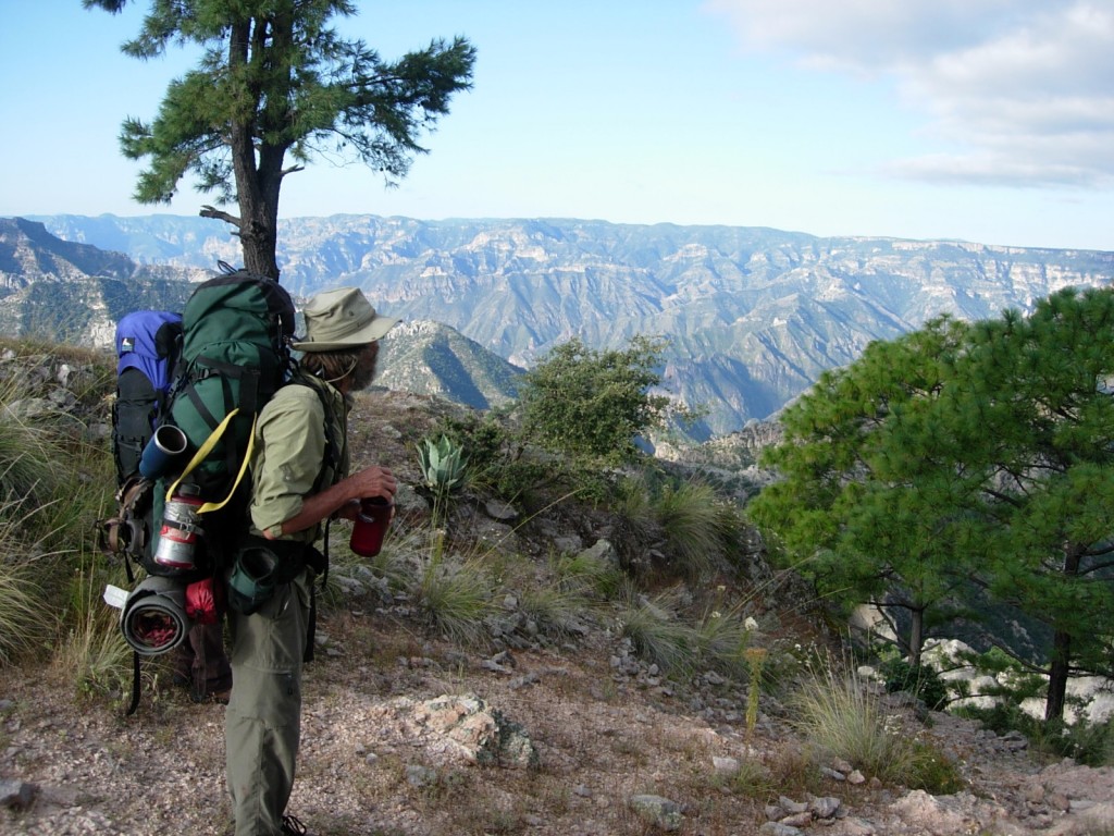
Mexico’s Copper Canyon Country.

Last weekend, I rented the much-anticipated movie version of Jack Kerouac’s seminal “On the Road.” Though I have never been the world’s most enthusiastic Kerouac fan, and though the movie did not especially appeal to me (at least partially because it did not stand alone very well; that is to say: a viewer would already have to be pretty familiar with Kerouac’s work in general, “On the Road” specifically and the macro-Kerouac mythos in order to “get it”), it did get me thinking about movement and lightness and, by extension, the possessions that sometimes weigh us down, especially as we age and become more sedentary.

At least I think that’s why I finally decided to write this story. Or maybe it’s that, having just successfully avoided any direct interactions with Black Friday and Cyber Monday (though, like most Americans, I was unable to avoid indirect interactions with the kickoff to what has lamentably become known as the “Holiday Shopping Season”), I am feeling ruminative about the entire concept of material acquisition, a subject that generally either bores me to tears, incites me to rage or inspires me to drink more than usual.

But, here’s the thing: Not all possessions are burdensome. Not all possessions weigh you down. Not all possessions possess their possessor. Three of the items I have treasured most in my life were mere pieces of paper, one of which had direct bearing to Kerouac and the cultural wake he left behind.

First things first.

Like many folks who came of age during the backsplash of the ’60s, which took a while to make their way to rural Gloucester County, Virginia, for most of my early adult life, I was one seriously mobile unit. As an example of simultaneous cause and effect, almost everything I owned fit nicely into a backpack and a trunk. If I planned to stay only a couple months wherever I was going — which was most often the case — the backpack was all I needed. Two pairs of ratty, thrift-shop-procured clothes. Down jacket. Ditty bag containing fundamental health and beauty aids. Cook kit with a cup and spoon. Sleeping bag and pad. Reading material and notebooks. Pipe and weed.

If I planned to park it for a full a season, which was generally as long as I stayed anywhere in those blurry days, I would have the trunk shipped in by bus by my mom and stepfather — both of whom were deep-rooted by nature — who likely spent much time wondering if their wayward son would ever apply the brakes long enough to leave a traceable forwarding address.

The trunk contained a few more changes of clothing, a portable record player, 50 or so of my favorite albums, an Underwood manual typewriter I bought for $40 at a pawn shop in Silver City while I was pretending to be a college student, a bong, a dictionary given to me as a high school graduation present by my mom and a Thesaurus given to me as a high school graduation present by a friend’s mom, a woman who was always ready to temporarily provide me with refuge when the hellfire of my fractured childhood home started burning a bit too hot.

It is axiomatic that a life on the road cannot include much in the way of personal effects. But that simplifies the situation for a great many of us. I did not travel lightly solely out of necessary expediency. There are two types of perpetual travelers: those more concerned with arriving and those more concerned with leaving. And I was a card-carrying member of the latter category, a man running from rather than to. Always leaving, always fleeing. When that’s your operational mindset, it’s not uncommon for stuff, sometimes important and cool stuff, to get left behind in a sometimes-frantic effort to find the closest exit.

The road giveth, and the road taketh away. That’s part of the deal.


1) Cecil and Alpine Beard lived about 10 miles outside remote Reserve, New Mexico, which, at that time, was a sometimes combustible sociological amalgam of multi-generational Anglo and Hispanic ranchers and Rainbow Family hippies. To get to their mostly rustic re-built adobe house (it had electricity and phone, but not much else in the way of modern amenities), you had to cross the San Francisco River a half-dozen times. Mostly, those crossings were easy, as the San Francisco is little more than a trickle up where the Beards lived. Sometimes, though, during monsoon season, the waters would rise to the point where Cecil and Alpine were cut off from civilization, such as it is in that part of the world, for days at a time, which suited them just fine, even though, by the time I made their acquaintance, they were in their mid-70s. Cecil and Alpine had moved to their compound in the middle of some of New Mexico’s most-nowhere nowhere in 1967 from the urban craziness of southern California, where Cecil worked for five years — from about 1935-40 — as an animator for Walt Disney Studios.

Cecil had been working as a muralist in Dallas when he saw an ad in a local paper soliciting applications for cartoonists for the brand-new Disney Studios in Los Angeles. He called and was hired on the phone.

His first assignment with Disney was to work on what many people have called the most-outstanding full-length animated movie ever made: “Snow White.” After that, he was assigned to another noteworthy Disney animated creation: “Bambi.”

Cecil left Disney shortly after “Bambi” was released to embark upon what ended up being his career right up till the point when I met him and Alpine: He became a professional creator of comic books.

I visited Cecil and Alpine three or four times, interviewing them for stories for the El Paso Times, where I was working as a reporter, and New Mexico magazine. Though they were very private people who, as they told me on several occasions, really didn’t like company, they were graciousness incarnate. Even though I was at that point in my life still what one lady friend described as a “wild child,” I was intrigued by the Beard’s living situation, which was all the more captivating to me because it was clutter free. Until then, I had always associated long-term domesticity with perpetual accumulation. But, not the Beards. They had no TV or music system. Their furnishings were simple and sparse. And it wasn’t because, like so many of the hippies living in Catron County at that time, they could afford no other lifestyle option. Though I of course never asked about their income, they worked every day. For many years, they completed a dozen comic books per month. By the time I met them, they were down to one a week. They had the bearing of people who were fiscally comfortable.

“Bugs Bunny,” “The Roadrunner” and “Dennis the Menace” were their staples. Sometimes Cecil would come up with the plots; sometimes Alpine would. Cecil would then do a rough set of storyboard illustrations. They would package them up and send them off during their twice-monthly journeys into Reserve. They never saw the finished products. Didn’t care to. And, even though several of their stories were eventually made into television specials, their TV-lessness prevented them from eyeballing the fruits of their labor. Checks came as regularly as comic books went out. And life was good.

The last time I visited the Beards, I could tell they were getting a tad impatient with my endless series of journalistic interrogatives. They never overtly pointed me toward the door, but an unmistakable hint was dropped when Cecil told me that he and Alpine would like to give me a “parting gift.” He pulled out two pieces of old rolled-up sketchbook paper and handed them to me. I carefully unrolled the almost-brittle pages and found upon them numerous pencil drawings of a certain well-known baby deer character. What Cecil and Alpine Beard had given me were two of the original sheets upon which the character of “Bambi” was being brought to life. “Bambi’s” final form had not yet been determined. There were probably 15 different versions of “Bambi,” some rough, some honed, some drawn by Cecil, some drawn by other Disney animators.

This was a splendid gift indeed, but one that I really did not know how to integrate into my wild-child life.

Over the course of the next couple years, I lived in a utility-less camper trailer way out in the desert, got laid off from my gig at the El Paso Times, worked on a juvenile-delinquent-rehabilitation wagon train in Nevada, moved to Denver — with, yes, nothing more than a backpack and trunk — where I slept on a friend’s couch till I could afford a hovel of my own, worked as a busboy in one of the Mile High City’s first high-end yuppie/snob restaurants, sold blood plasma to help make ends meet and, eventually, moved to a non-winterized cabin in the Colorado High Country — with, yes, nothing more than a backpack and a trunk — where I took a gig as a reporter for a small-town weekly paper. Less than a month later, I met the woman who would become Mrs. Hyphenated-Fayhee. Gay and I rented an ancient 36×8 trailer in Grand Lake, a tight-quarters living arrangement that necessitated a minimalist lifestyle. The following fall, we put all our shit into storage in the basement of Gay’s dad’s dental office and embarked upon a meandering multi-month foray that took us as far south as Costa Rica.

Somewhere along the line, those drawings of “Bambi” went their own way. There’s a good possibility they were horked by a roommate, as the non-winterized cabin I called home for most of the rough winter of 1983-84 was more like a dormitory, with roommates coming and going so fast, it was not unusual to find yourself cooking next to someone whose name you did not know. And it would not have been the first time that items stored in the basement of Gay’s dad’s dental office went missing. Or maybe I simply accidentally threw those irreplaceable drawings away. Who knows? They were gone. They are still gone.
I heard several years later that Cecil had passed away and that Alpine, feeling it prudent to dwell a bit closer to fellow humans as she passed her eighth decade, sold her house outside Reserve and moved to Pleasanton, New Mexico — which is not exactly Manhattan — where she, too, eventually succumbed.

Every time I have told this story in the presence of my wife, a woman who loved “Bambi” so much that she named her all-time best cat “Flower,” after a skunk that was a major character in the movie, her eyes tear up because it seriously makes her wonder about the psychic constitution of the man with whom she shares her life. I mean, who the fuck would lose original drawings of “Bambi” given to him by one of the people who worked on that movie? And this very reasonable question/concern transcends by leaps and bounds the very real observation that those drawings might actually be worth some money.

There are some things in the world that are so intrinsically and inherently wonderful, they deserve focused attention, protection and preservation, even by someone who was at that time predisposed to run like the wind whenever his backpack and trunk got even a little bit too heavy. I could have put them in a safety deposit box, even though I did not have a bank account. I could have sent them home to Virginia for safekeeping in a house that was always one drunken mental meltdown away from volcanic eruption. Fuck, I could have given them to a random person on the street in hopes they would at least survive.

Yet I did none of that.

I suspect my wife has long wondered, if I could be so cavalier with something so obviously and blatantly precious, what else could I leave behind?

It’s amazing how heavy paper can be.


2) Many are the people who rationally contend that, if you can travel together under arduous circumstances as a couple without negative reactions and consequences, then you are perhaps meant to be together. Or at least there’s hope. There are those who argue that, if you can’t travel together, then there is no hope, which may or may not be pretty much the same thing. When Gay and I were planning the multi-month journey that would eventually take us as far south as Costa Rica, we decided to invite my long-time amigo Norb and his wife Lori, partly because Norb was an aspiring photographer and I was looking at the trip through a journalistic lens, partly because, since we were going to be traveling through the heart of Central America’s Contra-era craziness, it seemed like a good idea to have more people in our group and partly because I think I was somewhat fretful about being alone for that long with one person. This marked the first time I had ever planned a journey with another person, much less a love interest. Until that point, my travels had always been solitary.

The first stop was in northern Mexico, a place I vaguely remembered some of my college chums talking about. A place called Copper Canyon. Though we did have with us a first-generation Hilary Bradt guidebook to the national parks of Central America, we had no orientational material whatsoever regarding Mexico. We flew from Denver to El Paso, crossed the Staunton Street Bridge into Juarez as the sun set, took a redeye bus to Chihuahua City and then hooked up with world-famous Chihuahua al Pacifico Railroad, which deposited us in a ramshackle trackside town called Creel.

There was no way I could possibly have known, could possibly even have guessed, the part that Creel would come to play in my professional life. At that point, it was yet another place I was passing through on my way to somewhere else. We got a room in the Hotel Nuevo and, having been up all night, slept most of the afternoon. Since there were then no maps of the area (man, I miss those days), at dinner at Lupita’s, we asked rudimentary tourist questions of the staff and learned that, about 10 miles south of town, there was a pretty little lake, called Arareco, where we could camp. From there, we were told, we could access Copper Canyon itself.

“Como — how?” I, being the closest thing to a Spanish speaker in our group, queried.

“Como quieren — however you want,” was the poetically cryptic response.

“Well,” thought I, “that IS the best way to get someplace.”

We hoisted our packs the next morning and began to walk down a lonely dirt road — now a busy paved highway — toward the lake. Before we passed out of Creel, we were approached by a Tarahumara Indian man who was so drunk, he could barely stand. He had puke spittles dried on his lips and breath that could knock a buzzard off a shitwagon. His eyes were blood red and wild. And he was belligerent and confrontative. Though I did not and still do not know more than a handful of words of Tarahumara, it was clear as a bell that he was cursing our existence in general and our existence in this particular neck of the woods specifically. We tried to calm him down, to explain to him in a language he did not comprehend that we were just passing through and that we meant no harm and that, basically, if he did not get the fuck out of our faces, Norb and I were going to pummel his drunken, belligerent, diminutive ass right there on the side of the road.

At that, he seemed to take even more offense. He pulled his fist back so far he likely strained his shoulder, apparently preparing to launch a haymaker in my general direction that took so long to engage, my grandmother could have blocked it with her cane. But there was no opportunity to block it, as the momentum of his backswing was such that the inertia carried him ass over teakettle backwards down a steep and fairly long embankment and deposited him unceremoniously in a rocky ravine. Once the dust settled, he did not move. He appeared to be dead. For about point-two seconds, we considered climbing down to take his pulse and perhaps resuscitate his seeming lifeless corpse, but thought better of it, as surely such a benevolent act on our part would invariably lead to an interface with local officialdom, something we wanted to avoid at all costs. Rationally figuring that a visit to the local hoosegow on a suspected charge of murdering a drunk local was not the best way to kick off our journey, we sauntered on as though nothing had happened.

Shortly thereafter, a multi-colored, heavily dented, smoke-spewing pickup truck of extremely indeterminate lineage stopped next to us. “What now?” we wondered. In the cab of the venerable vehicle sat something on the order of 14 people, all of whom were attired in the crazy colorful manner preferred by the Tarahumara. Except the driver. He wore a captivating mix-and-match ensemble that looked like it was procured at a thrift store that only accepted donations from other thrift stores. And he was so crusty/dusty that he looked less like a human being than he did part of the surrounding arid landscape. He had wood smoke in his eyebrows. It was only when he parted his lips that we realized he was an American. An American sporting a facial expression that can best be described as borderline gobsmacked. This was back when tourists were very rare commodities in the Copper Canyon area — a situation that has changed drastically in the interim.

“You folks lost?” he asked with an inflection that indicated he thought maybe we were looking for Paris rather than Copper Canyon.

“Well, we’re not what I would call found,” I responded.

I told him that we had heard about Lago Arareco. He offered to drive us there, so we loaded ourselves into a pickup bed that held much in the way of miscellany. Strands of rope. Smooshed cardboard boxes. Crushed beer cans. A desiccated saddle that very well might have used by B. Traven as he was looking for treasure in the Sierra Madre. A live goat. Three dead chickens. Piles of books and magazines that had been left out in the weather.

When the crusty/dusty gringo dropped us off, he asked about our plans. We told him that we intended to hike into Copper Canyon though, very much like Frodo having to ask Elrond the directions to Mordor, we admitted that we had no earthly idea how to get to Copper Canyon. We assumed, we told him, that, if we simply took out hiking, we would at some point find ourselves staring down into an abyss as large as the Grand Canyon.

We were told it was a bit more complicated than that, that we ought to consider adding some actual information to an exploration strategy at that point overly reliant upon happenstance.

He proceeded to dig through the two-foot-high pile of unidentifiable detritus that covered the interior floorboard and pulled out a soiled and crumpled envelope. Upon the back of that envelope, he thoughtfully and deliberately hand-drew a map that, if the gods were in an unlikely benevolent mood, would lead us, after six or so hours of hard slogging, to a place called Recohuata Hot Springs, located at the bottom of a side canyon that, if followed far enough, would eventually open up into the deepest depths of Copper Canyon proper. He provided a running directional commentary as he drew squiggly lines that represented dirt tracks through the wilderness, and as he highlighted potentially confusing intersections, and as he tried to estimate distances, and as he pointed out landmarks, and as he said stuff like, “Make sure you don’t go this way” and as he finally and reluctantly handed the map over with a look on his face that betrayed an obvious feeling that he was actually doing us a disservice, that he felt there was no hope whatsoever we would ever find Recohuata Hot Springs and that, some day, our bodies would be found 100 miles off in completely the wrong direction and that it would be his fault.

After camping for two days at Lago Arareco, we set off in what we thought was more or less the right direction with the kind of yin-yang enthusiastic trepidation that often accompanies hand-drawn-envelope-map-driven forays into rugged foreign realms. Ordinarily, I am perfectly comfortable with these types of outings. I am confident in both my orientational and survival acumen. But our gracious map-giver had stressed that we would not find so much as a drop of water between the lake and Recohuata. And it was late-summer hot.

We hiked diligently. We made shoulder-shrugging guesses at several junctions that did not appear on the map, or at least did not appear to appear. We frustratingly backtracked a few times. We argued whether this rock formation or that giant juniper was the one the gringo was talking about. And we walked, and we walked. By evening, we were fatigued and near-bouts dry. We decided unanimously to try to work our way down into the closest drainage in hopes that we would accidentally trip over a spring or at least a stagnant pool of moist pond scum. As long as it was wet. We found what appeared to be a goat trail and followed its rocky, overgrown tread down what turned out to be about 800 vertical feet. At the bottom — shocker of shockers! — was a stream and a series of deep turquoise-colored pools. It took a bit of downstream bushwhacking to find a place level enough to camp, but, when we did, we could not help but notice there were several streamside hot spring pools. We had, somehow, stumbled our way to Recohuata, our actual destination. Though I tried to act cool, like there was absolutely no doubt we would arrive right where we were supposed to arrive, truth be told, I was stunned.

After a well-deserved day of hanging out in the hot springs, we dayhiked downstream, thinking that, sooner rather than later, we would round a bend and there would be Copper Canyon. But concern with the security our the gear we left behind unattended in camp made us turn around prematurely. We hiked out of Recohuata the same way we came in, hitchhiked back to Creel, caught the train and rode it down to the Pacific coast. From there, we rode trains and buses all the way to the heart of war-town Central America. The hand-drawn map to Recohuata was with me the entire way, and stayed with me when we finally returned home to Colorado.

Of all the astounding places we visited on the trip — Caye Caulker, Tikal, Lago Atitlan, Santa Rosa National Park — it was the area around Creel, Lago Arareco and Recohuata Hot Springs that most stuck with me. A year later, I returned to Recohuata Hot Springs with a friend with the idea of hiking down to Copper Canyon, a journey I expected would take a couple days. It took us almost a week. And that week was off-the-goddamned-scale intense. By the time we dragged our beat-up carcasses into Copper Canyon, our clothes were in tatters and we boasted more cuts, scrapes and bruises than we did unscathed skin. We were out of food. We were almost delirious with fatigue. And we still had to hike out of one of North America’s deepest canyons. And we didn’t know the way.

The year after that, I returned once again to Copper Canyon, a journey that resulted in my first cover story for Backpacker magazine. That cover story resulted in my first book contract, a backpacking guide/travelogue to the entire Copper Canyon region. And that book resulted in me getting a contract to do a coffee table book about the then-new Colorado Trail. And I ended up guiding backcountry trips into Copper Canyon. I ended up going down there dozens of times.

It’s of course impossible to say how that first trip into the Copper Canyon area would have turned out had that dusty/crusty gringo not stopped to give us a ride and had he not drawn us that map. Perhaps we would have ended up in Batopilas. Maybe Urique. Maybe my life would have turned out plus-or-minus how it turned out. But maybe we would have said fuck it after wandering through the woods without ever having found that goat path into the depths of one of the most mysterious and remote and sometimes scary places on the planet, a place that came to feel like a second home to me.

I had that hand-drawn map for several years, but, like the drawings of Bambi, somewhere along the line, it was lost. Part of me thinks I sent it in to the editors at Backpacker for use with the Copper Canyon cover story and they didn’t send it back. More than likely, though, it just got tossed.

One of the best aspects of our fleeting little inconsequential lives is how one seemingly innocuous thing can snowball, how a map hand drawn on the back of a dirty envelope can lead a person to a destination called the rest of his life. But it did.

It’s amazing how substantial paper can be.


3) To this day, I say that, were I inclined toward urban living, Denver would be the place, partially because it is a vibrant city and partially because it is fairly close to decidedly non-urban environs. But I am not inclined toward urban living, which runs counter in many ways to the notion of trying to make your living as a freelance writer. After all, a large percentage of publications are found in cities, and there’s always lots going on and, therefore, lots to write about.

But …

I lived in Denver for four-plus years — nine months when I first moved to Colorado from New Mexico in 1982 and then from 1985-88. Gay and I got married in Denver. And I truly believe that, given the right domestic circumstances (which likely would not include yours truly!), my wife would be perfectly happy to call the Mile High City — the place of her birth — home forevermore. But, again, I am definitely not a city person, and, despite the perpetual hustle and bustle, I found myself during my time in Denver flailing for story ideas in ways and to a degree that I do not often experience in rural areas. By a long shot. In the boondocks, I can go for a short walk or drive and come back with 15 story ideas. Matter of fact, it’s one of the things I’m best known for in my small world. I’ve given seminars to young writers and reporters on the generation of story ideas. Yet, I guess the noise and the lights and the incessant movement and the density of the urban ecosystem overwhelm my mental circuitry.

Still …

During the time I lived in Denver, I wrote like a crazed banshee on speed. For several years, I was writing, and getting published, more than 15,000 words a week. (For those of you not used to thinking in terms of word count, understand: that’s a shitload.) I wrote for almost every issue of Denver magazine, Denver Business magazine and the Boulder County Business Report. I was also the main writer for a long-defunct Denver weekly called City Edition. It was during that time that I began my long relationship with Backpacker magazine. It was crazy, but, because of the aforementioned challenges I constantly faced generating story ideas, or, better stated, ideas that translated to newspaper and magazine articles that were actually appropriate for and appreciated by an urban readership, I felt like I was constantly hanging by the last molecules of my fingertips from a steep and high cliff.

And did I mention I was also drinking fairly heavily and hanging out with a tribe of Bohemian poets who blew cocaine not just during breakfast, but as breakfast?

I do not remember the actual genesis, but somewhere along the line, I developed an interest in following in Kerouac’s Denver footsteps, of actually finding and visiting the physical locations Kerouac wrote about in those of his works that included references to his Western travels. This was easier said than done, because, first, as I stated many words ago, I was never really a big Kerouac fan, though I always respected, and still respect, his justified prominent place in American literary history. Thus, I did not have his haunts memorized the same way a true disciple would. And, second, Denver was right then going through a substantial metamorphosis from cowtown to … whatever it is now. LoDo, which did not yet have that name, was still nothing more than a series of abandoned warehouses. Confluence Park, where the REI flagship store now is, was skid row. Broadway Terrace, where the Mayan Theater is and where I once lived and drank, was worse than skid row. Though a large part of Denver’s metamorphosis consisted of architectural preservation and restoration, it was becoming increasingly difficult to find remnants of the past beneath the veneer that was then being slathered onto the exterior of what was long known as the Queen City of the Plains. I asked the Denver and Colorado historical society people what they knew about Kerouac. I tried the tourism bureau. I tried the history and literature departments at Metropolitan State University. None could tell me where Kerouac drank and slept.
Then it dawned on me to try to communicate directly with one of the recurring characters in Kerouac’s work: Allen Ginsberg, the poet laureate of the Beat Generation and a frequent companion of Kerouac. Ginsberg is the thinly veiled Carlo Marx character in “On the Road” (both the book and the afore-referenced movie), and his unveiling of “Howl” — probably the most-important, most-groundbreaking and flat-out best American poem since Walt Whitman’s “Song of Myself” — at the Six Gallery Reading in San Francisco in October 1955 (a mere two months before I was born), is recounted in barely fictionalized form in Kerouac’s “The Dharma Bums.” (Ask me if I would give a left nut to be magically transported back in time to the Six Gallery Reading.) In 1974, Ginsberg helped found the Jack Kerouac School of Disembodied Poets at the Naropa Institute (now Naropa University) in Boulder.

Given my lack of luck hunting down Kerouac’s old haunts via what could be termed traditional means, I decided to send a letter to Ginsberg asking for his help. I addressed the letter, which was succinct and contained a modest exaggeration of my academic and literary CV, as well as an ambiguous outline of my intent, to Allen Ginsberg, c/o Naropa. I, of course assumed no reply would be forthcoming but, several months later — long enough that I had essentially given up on the Kerouac story idea — I got a personal, detailed response from Ginsberg, one of the most-influential poets in American history. I mean, fuck! In his response, Ginsberg graciously praised me coming up with such a great idea, telling me how he had been thinking of pursuing a similar project for years. He suggested putting together a map that Kerouac aficionados could follow around, like those maps of where stars live in Hollywood. He told me about a couple of Kerouac’s old haunts that might still be standing, told me about a few others that had been razed and told me about a few others with locations he could not recollect. He signed the note with a valediction: “Let me know how this turns out, Allen.”

I could not believe my eyes.

I half-heartedly tried to hunt down a couple of the places Ginsberg referenced in his note, but I never got around to writing the story. It just seemed that the ghost images of Kerouac and Neal Cassady and even Ginsberg were too long gone, too obliterated by the new Denver, the shiny affluent modern Denver that was right then rising from the city’s colorful skid-row ashes. It was while I was wandering around erstwhile decrepit neighborhoods that were quickly becoming gentrified beyond recognition that I decided it was high time I got out of the city, lest I wake up in 20 years still there, wishing the whole time I was somewhere else.

Not long thereafter, Gay and I packed our shit up yet again and stored it, yet again, in the basement of her dad’s dental office. We loaded up our old Toyota pick-up truck and headed back to Copper Canyon where, for several months, we lived in a tent and backpacked hundreds and hundreds of miles all over the place doing research for my first book.

Though I do not know his work well enough to make a cogent comment, I believe Kerouac would have approved of my lifestyle choice, of my willingness, of my need, to travel lightly to and through off-the-map locales, to spend a large part of my life on the road.

I do not know whatever happened to the note I received from Alan Ginsberg, who passed away in 1997. Like the Bambi drawings and the hand-drawn map to Recohuata Hot Springs, one day, it just wasn’t there. It had disappeared. Maybe it didn’t want to end up framed on my office wall.

It’s amazing how influential a piece of paper can be.

Next time: Possessed, Part Two: A Tour of a Typewriter Collection

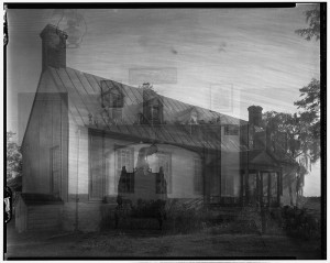
A double exposure of a house in Gloucester County, Virginia, I pulled from a public domain website. I don’t know why this image seems appropriate for this post, but it does.


Blogs

Flagging

Eyeball a map of New Mexico’s massive Gila National Forest and, off to the southwest of the Gila’s main body, you will see a detached section of green. At the heart of this detached swath of forest lie the Burro Mountains, which consist of three side-by-side 8,000-foot summits that, in loftier realms would be considered modest at best. Hereabouts in Gila Country, they are the mountains of home, a range visible from many miles away as you’re driving up from Tucson or the remote vastness of the Bootheel.

Through the Burro Mountains passes a section of the 3,100-mile-long Continental Divide National Scenic Trail as it winds it way between the Mexican and Canadian borders. The CDNST has since its legal establishment in 1978 consisted in these parts of a mismatched hodgepodge of single-track segments interspersed with rutted jeep tracks, washboardy dirt roads and even long segments of paved highway.

The powers that be at the Gila National Forest have never been, and will never be, inclined toward promoting the outdoor recreational opportunities offered up in spades within the Gila’s 3.3 million acres. Those powers that be have ever been, and ever will be, more focused on the needs and wants of the various extractive industries, mostly those centered upon bovines. Frustrating as this operational reality can be for those of us disinclined to interface with denuded, erosion-prone riparian zones, for many people who have grown tired of the cancer-like growth of the outdoor recreation industry that defines so many otherwise attractive places in the West, this lack of focus on trails and trail maintenance and the aggressive promotion of such is an acceptable trade-off. While we may have to slalom our way through endless piles of stinking, fly-infested cow caca, we rarely have to slalom our way through hordes of mountain bikers and gaggles of peak-baggers so focused upon their pursuits that they are unable to see the forest for the trees.

The Burro Mountains historically have been trail free. And I mean that in the absolute sense. For most of the time I have called this neck of the woods home, there was nary a millimeter of true trail through the Burros. There are vestiges of old logging roads and informal stock driveways, historic remnants of the mining activity that forever defined this mineral-rich area, and serving the transportation needs of the ranchers whose livestock still roam throughout the dry washes and cactus-covered ridgelines that form the bulk of the Burros.

Then came the CDNST, or, better stated, then came the administrative edict from the U.S. Forest Service’s higher-ups in D.C., encouraged by the powerful National Forest Foundation, to the various national forests through which the Continental Divide passes to get with the high-profile CDNST program. Thus, the first tentative tracks of the CDNST began to appear in the Burro Mountains. And, thus, the Burro Mountains, long the exclusive domain of ranchers, miners, ATV riders, gun nuts and sundry variations on the bubba theme, started seeing dayhikers, backpackers and, yes, sadly and inevitably, even mountain bikers.

The main section of the CDNST through the Burros followed a toponymically captivating geographic feature named Deadman Canyon, a heavily forested ravine that passes close to Mud Spring, the first natural water source on the entire CDNST if you’re traveling north from the Mexican border, some 10 arid hiking days away. (And, if you’re traveling south, well, Mud Spring is it; from hereon in, you’ll be slaking your thirst at stock tanks.) The CDNST route up Deadman Canyon — one of my favorite hikes — ascends to the 8,035-foot summit of Burro Peak, from where you can observe the heart of the Gila to the north and the magical bleakness of the Chihuahua Desert all the way south into Old Mexico.

Deadman Canyon Trail, despite being part and parcel of the CDNST, has never been heavily maintained. Nor has it ever been heavily traveled. Verily, though I have tromped upon it dozens and dozens of times, never once have I encountered another person, though I have seen plenty of boot prints and, more and more, mountain bike tracks.

Two years ago, as part of a permanent re-route of the CDNST being slowly and methodically (and, I should state, very tastefully) established to bypass the aforementioned sections of rutted jeep tracks, washboardy dirt roads and even long segments of paved highway, the Deadman Canyon section of single-track trail was essentially decommissioned; it is no longer a part of the CDNST. Thus, it is a section of trail in administrative limbo; whatever resources were allocated to maintain it while it was part of the national scenic trail system have been siphoned off to maintain the newly built, permanent sections of the CDNST. Slowly but surely, the Deadman Canyon Trail will whither away, till it likely has its official system status removed entirely.

And, to that I say: Hooray!

Though I suspect I still bushwhack off trail more than most of my back-toting brethren, I am now at an age where I find myself tromping upon tread far more than I used to. This chagrins my increasingly aged and infirmed self to no end, but, well, grim temporal reality, and the impact that reality has had on one’s physiology, is tough to ignore, especially for a person who does most of his hiking not only by his lonesome but in impromptu fashion (read: I do not often inform a responsible party of my itinerary, at least partially because I am not acquainted with many responsible parties, but mainly because, on those rare instances when I actually have an itinerary, I usually don’t know what it is still I’m on the trail and, even then, it’s almost always subject to real-time improvisation). If you are disposed to bushwhack, but are being visited more often than you used to be by Good Sense, the next-best option is unmaintained trail, which basically offers up the best of both backcountry worlds. While the Deadman Canyon Trail is not yet officially unmaintained, it essentially is, and soon will be.

As I said: Hooray!

I went up there with my dog, Casey, a few weeks ago, with the intent of hiking the two miles up to the new CDNST intersection, right below Mud Spring. My eye was caught and my heart sank almost immediately, for tied to trees and bushes and the occasional barbed-wire fence post were strips of lime-green surveyors’ flagging. As we all know, few are the times when surveyors’ flagging arrives on any scene — urban, rural or backcountry — when the result is anything save negative.

This I know more than most, having worked for three different land surveyors in three different states — Virginia, Illinois and New Mexico — during my formative years. Matter of fact, at one time, I seriously considered pursuing surveying as a life-long vocation and likely would have done so were it not for the unavoidable and unfortunate fact that I am essentially numerically illiterate, and, without finely honed math skills, one’s land-surveying advancement opportunities are limited. Still, it was tempting. Out in the woods all day, following in the footsteps of George Washington, Thomas Jefferson and many other historic luminaries. Especially during my surveying stint in Virginia, I would often find myself in a red-bricked pre-Revolutionary-War courthouse building searching through parchment documents with words upon them writ in flowery cursive script, telling me that the boundary marker I needed to find was hacked into a sweet gum stump … more than 200 years ago.

It was not just a decided lack of math skills, however, that ultimately waylaid my budding land-surveying career before it ever really got off the ground. The company I worked for in Virginia specialized in carving large farms into subdivisions. Farms that had been owned by the same families for generations were suddenly being hacked into developments with ironic names like Foxhunt Terrace, interlaced by ersatz streets with names like Wildlife Way.

It did not assuage my reaction to spending my days helping the process of eviscerating both the heritage and the ecology of my home county knowing that one of the biggest reasons this process was transpiring was because property taxes were rising in a seeming premeditated fashion so exponentially that many old families had no choice but to sell their acreage. I saw many an old farmer, who had lived his whole life upon the ground where I was working with my cohorts in surveying crime, break down into blubbering convulsions as ancient trees were felled and orchards bulldozed.

Even though I understood full well that many of those farms were, back in the murkiness of history, stolen from local Powhatan Indians and worked with slave labor, it still hurt to see them replaced with the kind of tasteless cookie-cutter commercialism that now defines America.

There was no way to stave the inevitable, and, if I had resigned my position in righteous indignation, someone else would have quickly and gladly stepped in to replace me. But I was not totally impotent; I had the ability to at least serve as a thorn in the side of the development of which I myself was part. Several of my like-minded compadres and I would often sneak back onto the very farms I was helping to slice up late at night, usually on weekends, and usually after having ingested copious amounts of various chemical courage-inducers, with destructive malice in our hearts.

Though I had lived in New Mexico for two years when I returned to my native turf in the Old Dominion for the requisite year back home before casting one’s lot with the West forevermore (yes, there was a woman involved, one who proved both her intelligence and perceptive nature by unceremoniously dumping my ass), I can not remember whether I had at that time read any Edward Abbey. I seriously don’t believe I had, but I might have. Therefore I cannot claim original thinking when it came to my eventual reaction to land surveying, or, more accurately stated, my reaction to the effects of land surveying.

Years later, when I indeed interfaced with Abbey and his self-congratulatory rantings regarding land surveying, where he boasted lamely about removing surveyors’ stakes, I remember thinking how much of a fucking amateur he was. The process of simply removing the more obvious evidence left behind by land surveyors, while certainly causing inconvenience, is nothing more than a pain in the ass that is generally pretty easily discovered and rectified by simply recreating, via the various control hubs located throughout any project being surveyed, that which was removed by recreational monkey-wrenchers. Matter of fact, a large part of the strategy involved with any large-scale surveying project is building in means by which disturbed markers can easily be relocated.

The true skill in fucking up a land-surveying project comes from being able to locate those control stations, the points from which all other parts of the project are measured, the points from which projects are made relative to the rest of the surveyed world. Had Abbey done his homework, he would have known that, if you want to fuck with the efforts of land surveyors and, by extension, the projects they are working on, very un-Abbey-esque subtlety is the best path.

You need to have an eye for the mechanics of a project to locate the control stations. The company I worked for in Colonial Virginia used 2×2 wooden stakes with a flooring tack nailed into the top. The entire project was measured from not just that tack, but the very center of that tack. In most larger surveying projects, you’re measuring to one-one-hundredth of a foot. In construction surveying, that becomes one-one-thousandth. It does not take much of a tweak of a control hub to cause exponential increases in mis-measurement throughout a project. Matter of fact, if you move a control stake too far, the fact that it has been tampered with will be obvious to the instrument operator next time he or she sets the theodolite up. Move a control hub a mere inch and you can wreak havoc upon a project, making it so property lines are established incorrectly. If you manage to find more than one control station, your efforts at land preservation can translate down the development road to having buildings constructed with property lines running through the middle of them. You can make it so people’s lives are impacted by litigation for years, maybe even decades, to come.

For most of the year I worked land surveying on Colonial Virginia, it was not uncommon for me and several of my co-employees to visit by night the very sites we worked on by day. I knew full well that there were don’t-bite-the-hand-that-feeds-you-type moral implications at play during our nocturnal efforts to set wrongs aright, even if only temporarily. But, as far as I was concerned, those moral implications were clearly mitigated by the fact that the hand that then fed me fed me to the tune of literally $3 an hour. That hand also demanded considerable overtime work on weekends, and steadfastly refused to pay time-and-a-half. So, basically, well, fuck him and the horse he rode in on.

Though I knew I would be long gone before the eventual ramifications of our modest efforts reached fruition — if indeed they ever would — I used to lie in bed in my shithole trailer, smirking at the thought of civil court cases raging for generations because of the well-intentioned efforts of a handful of stoned reprobates. I realized at that point how much fun it was to fuck with The Man for no reason more intellectually complex than the sheer joy of fucking with The Man.

Still, the rampant development of an area that had been hyper-rural throughout its long and storied history — this being the county where Pocahantas was born, this being the county where George Washington quartered his troops before the Battle of Yorktown, this being the heart of the bloody Peninsula Campaign in the Civil War — continued pretty much unabated. The bulldozers always arrived on schedule, plowing down verdant semi-tropical hardwood forests for which, when push came to shove, I had very little in the way of emotional attachment. That part of the country was simply not My Place.

The Gila National Forest of southwest New Mexico, where I first arrived sight unseen in July 1976 — even as the tall ships were descending upon the east coast in full Bicentennial fervor — on the other hand is My Place. Always has been, even before I was born, and always will be, even after I am long gone.

During an especially lean fiscal time, I became employed by a land surveyor in Gila Country, part-time in the late-’70s. By this time, I know for a fact I had read several of Abbey’s books, and I’m sure his observations about recreational surveyors’ stake removal had been processed through my rudimentary mental philosophical filters. But I never once even pondered the notion of reprising my Colonial Virginia nocturnal shenanigans. For one thing, the man I worked for was one of the truly great people it has ever been my pleasure to associate with professionally. For another, we worked mainly in the unpeopled Mimbres Valley, where, to my still-wet-behind-the-ears eyes, there was absolutely no chance whatsoever of bulldozers plowing the juniper and piñon forests under. Well, I was wrong about that, as the Mimbres Valley — the very area I helped survey — is now home to endless vistas filled with the tackiest low-level platted half-acre-lot, manufactured housing subdivisions imaginable.

Shit!

I have not worked in the land-surveying profession for more than 30 years now. For a while, I would occasionally stop to move or remove sakes or property markers that had spouted in places where they ought not have, but, like most of my youthful fancies, those efforts trickled away as my life moved inexorably closer to a mainstream that at this point pretty much defines it.

What has definitely not trickled away has been my ability to notice surveyors’ flagging and to wince accordingly.

The flagging up Deadman Canyon began at the trailhead and continued at regular intervals along the trail as it made it way up toward Mud Spring, the CDNST intersection and, eventually, the summit of Burro Peak. The flagging was not fresh, but neither was it stale. It had not yet become brittle, but its color had started to fade a bit. I estimated that it had been placed along the trail a few months prior, meaning mid-winter.

I could not for the life of me ascertain its function.

Though the flagging followed the trail exactly, I doubt it was placed to delineate the trail’s route, as it is still very obvious, despite the fact that its status, like I said earlier, had been downgraded.

I briefly considered that the flagging was placed at spots where someone — perhaps a Forest Service trail crew employee — wanted GPS coordinates taken so the trail could be entered into a database. But the flagging’s placement did not support that theory.

Had a Forest Service trail crew come through to mark the trail corridor for a future re-design, there would have been sections that ventured from the more poorly designed sections of the existing tread. There were none of those.

Besides, most Forest Service trail crews work in the summer, not the dead of winter.

Perhaps a local senior citizen hiking group had planned a trek upon this section of trail and, to ensure that those members of the group who did not possess enough in the way of backcountry navigation skills to stay upon obvious tread and/or to stay with the group, some well-meaning person had placed copious quantities of surveyors’ flagging along the route, like bright-green breadcrumbs. Perhaps that person did not get around to coming back to retrieve the flagging. Or maybe someone else was supposed to do just that and he or she forgot, or thought someone else was supposed to do it.

Then it dawned on me that, possibly, the Deadman Canyon Trail was not being downgraded at all. Possibly, this flagging was indicative of a decision to actually upgrade it, to make it more easily passable for senior citizen hiking groups and mountain bikers. Perhaps the plan was to brush it out, to widen it, to add more signage.

Yikes!

No matter its genesis, I looked upon the flagging adorning the Deadman Canyon Trail as nothing more than litter. And I hate litter. So I started pulling it off every tree, every bush, every barbed-wire fencepost upon which it fluttered in the springtime wind.

I thought that, maybe, as a result of my efforts, some Forest Service person was going to have to come back in to re-flag the trail. But, I figured, if that’s the worst thing that happens to that Forest Service employee, his or her life ain’t half bad.

Then I thought that perhaps my de-flagging marathon might result in some hapless senior citizen getting directionally discombobulated. Maybe that person — someone’s kindly grandfather — would die an agonizing death alone in the woods as a result. But, I figured that, well, if you need flagging to stay on course in the woods, you ought not venture out of town. And, if you get lost, you have the opportunity to learn many lessons not available to those who remain found.

Soon, both pockets began to bulge with flagging. I had to start transferring the large wads of removed surveyors’ flagging into my daypack, while, likewise, soon began to bulge. There was a lot of flagging.

At one point, the Deadman Canyon Trail leaves the canyon proper and ascends steeply up a hillside. It re-connects with the canyon about a half-mile farther up. Trails are often designed thus in the Southwest to bypass box canyons, places that are often too rocky or precipitous to safely traverse. I had always wanted to venture up that section of canyon bypassed by the trail, and this seemed as good a time as any. I could see that the flagging was still lining the trail as it went up the hill. I figured, if I were indeed able to successfully negotiate the canyon bottom up to the point where it reconnected with the trail, I’d be able to collect the flagging on the way back down. And, if there was some sort of impassable obstacle, I would simply turn around and proceed up the hill on the trail — meaning I would collect the flagging then. And, if what I found on my bushwhack up the canyon was the cause of its ominous appellation then, somewhere in the future, someone — maybe a hunter or a rancher — would stumble upon a corpse whose pockets were inexplicably filled with surveyors’ flagging.

No sooner had I left the trail and started making my way up the trail-less canyon bottom than I spied, of all disheartening things, bright green surveyors’ flagging lining a route that ended up being easily passable. This made no sense and countered whatever innocent explanations I had mentally conjured earlier about the origins of this goddamned flagging epidemic. Some cocksucker was clearly up to no good! Maybe this flagging had nothing whatsoever to do with the trail itself. Maybe its proximity to the trail was mere coincidence. Maybe there was a logging operation in the planning stages.

Shit!

I removed every single strip of flagging between the CDNST junction and the Deadman Canyon Trailhead. It ended up filling to brimming one of those kinds of plastic grocery bags that are now being categorically dissed by people trying to save the world.

I will likely never know who placed that flagging along Deadman Canyon. Or why. Until and unless, that is, I show up one day, ready to hike to Mud Spring or Burro Peak, only to discover chainsaws or bulldozers or some other manifestation of the forces of development evil. Maybe I will then overhear a worker castigating the motherfucker who removed the flagging that was placed to orient their destructive activities.

We all eventually reach an age when we realize, to steal a line from “V for Vendetta,” that almost every change you have seen in your life is for the worse. You find yourself indoctrinated by the concept of the inevitable. You find yourself spending more time trying to figure out how to dodge the inevitable rather than trying to figure out how to confront it. You find yourself replaying the parable of the little Dutch boy putting his finger in the leaking dyke. You find yourself thinking that bulldozers are the fated norm.

You go to meetings. You write letters to the editor. You sign petitions. You send money to MoveOn.org. You subscribe to Mother Jones. You re-read Edward Abbey. You shake your skinny fist at the darkening sky. You campaign for the least-fucked-up asshole on the ballot, only to learn that he or she is 10 times more fucked up than you ever thought possible. And still trees get mowed down. And tacky cookie-cutter subdivisions fill places like the Mimbres Valley. And pristine swaths of desert get plowed under to make room for massive solar arrays so we can have our cake and eat it too. And the rainforest gets plowed under to make room for “sustainable” sugarcane plantations so we can continue to smugly drive our goddamned cars to the goddamned trailhead. And you are told over and over that you can’t stop progress. And you get labeled a rebel or a malcontent or an idealist or an eco-terrorist (all of which are compliments in my book) or, worst, naïve if you respond that destruction is not progress and that, yes, fuck you, we can stop it. But you know that, in order to stop that which the agents of destruction call progress, you might have to condone monstrous acts, and maybe even become a monster yourself. And you sometimes get to thinking as you’re hiking alone out in the quiet woods that maybe the only hope left for the world is a total collapse of civilization. But then you think, fuck, as my wife says, in most ways, that would be a flat-out pain in the ass. You realize you have neither the stones nor the energy to go down that path. You realize you have neither the stones nor the energy to burn shit down and to blow shit up and to maybe even take a life in the name of a greater good that most of us could not define if our lives depend on it. You realize you no longer have the courage of your convictions. Maybe you never did. Probably you never did.

So, you’re left with the flaccid act of removing surveyors’ flagging from the side of a trail hardly anyone ever visits. Not out of hope, but out of a frustration that now defines your life clear down to its mortal core.

Cameroon Diary

Cameroon Diary 3: Tracks in the Sand

One of the most-glaring seeming contradictions with regards to your average modern-American (especially of the Western U.S. variety) self-propelled outdoor recreationist is that, while we might be able to sniff the air to plus-or-minus ascertain whether precipitation is imminent, and while we may be able to, with a little luck, find our way through an area that two years ago was devastated by wildfire, when it comes to sussing out the ways of wildlife, most of us are decidedly lacking in even most rudimentary ability.

“Pathfinder” most backpackers, backcountry skiers, climbers and mountain bikers are not.

It oft-times chagrins those of us who adorn ourselves with garments manufactured by The North Face and Royal Robbins that “sportsmen” — hunters and fisherpeople — are significantly more capable than are backpackers, backcountry skiers, climbers and mountain bikers when it comes to locating wildlife. We may hike into a place known to harbor elk or bears, but, for most of us, any interface that might result comes by way of pure happenstance. This is especially frustrating for those of us who would gladly trade a long-winded view of Yosemite Falls for a fleeting glimpse of a mountain lion. But it is what it is.

The RhinoBuster — a poor man’s LandCruiser.

Gay and I flew into the sub-Saharan town of Maroua (accent, like most towns in Cameroon’s Extreme Nord province, on the first syllable: MAR-oo-ah). For the first time in our lives, we had hired guides, sight unseen, via the Internet, prior to our arrival. There was no give and take on this decision. Our destination was the famed Waza National Park, one of the most-impressive and remote wildlife-viewing destinations in all of West Africa. Since it is illegal to enter the park without a vehicle and without a guide, we had little choice but to shell out hard-earned cash for the services of a driver, a young Muslim named Moussa, a guide named Marga (the brother of the man who owned and operated the tour company) and, more importantly, a vehicle, a 4WD SUV that was apparently Nissan’s equivalent of a Toyota LandCruiser. (The specific model was something like “RhinoBuster,” a model I had never before seen on the streets of relatively rhino free New Mexico.) I, an ex-LandCruiser owner, was hoping for and actual ’Cruiser, so we could feel like we were participating in a National Geographic documentary. I mean, who travels through the hinterlands of Africa in a fucking Nissan?

After seeing to last-minute supply-procurement details in Maroua, Moussa pointed us northward toward Waza, two delightfully bone-jarring hours away. It was during this sweltering introduction into local climatic reality that we learned that Moussa spoke nary a syllable of English and that what little English Marga spoke was lost in a linguistically unidentifiable accent so thick that we came away from every conversation more befuddled than if he had never parted his lips.

By the time we got to Waza, daylight was fading fast. Through much effort, we were able to ascertain that Marga was asking us if we wanted to enter the park, which officially closed to visitation at dusk, for a quick visit, or did we want to just journey forth to our hotel and hit the park first thing in the mañana? Fuck yeah, we wanted to visit the park right then and there!

Entry to Waza.

We stopped at the entry station and picked up the legally required ranger and tracker. That made for six people crammed into the RhinoBuster, which could not have been caked any more with dust if a backhoe had unleashed a torrent of fill dirt into the interior.

Dry country.

In the part of the world I call home — southwest New Mexico — we are assuredly dealing with what local meteorologists are calling a “drought.” And, relativity notwithstanding, things are indeed parched in Gila Country. But, anytime you overlay the word “drought” with the word “Sahara,” you know you are entering a realm of scorching aridity that sets its own standard. This part of Cameroon was topographically featureless. Dust devils defined the horizon. All along our route, colorfully attired women walked great distances with pots atop their heads to the one moist-ish puddle for 50 miles, where they would sit and squeeze a thimblefuls of dirty moisture from the ooze, before returning to their thatched village several on-foot hours away. It was at least 105 degrees. And, until we arrived at the protected gates of Waza, vegetation was sparse in the extreme.

Though I could not understand their discourse, I could tell that the driver, the guide, the ranger and the tracker were all concerned. It did not take a linguistic scholar to understand that, given the desiccated nature of the surrounding terrain, they were worried that the wildlife viewing might be disappointing, a reality that would surely effect our remunerative largesse once post-trip tip time rolled around.

Waza National Park, according to the literature, is home to beaucoup quantities of giraffes, elephants, rhinos and lions. The entire elephant and rhino populations had apparently migrated out of the park for wetter environs, which was disappointing in the extreme, we having just journeyed halfway around the planet to see they unaccommodating asses and all.

But, we were told (or at least I think we were told), there were still plenty of giraffes and, if we were lucky, lions.

The tracker.

Several times, the tracker asked that the RhinoBuster be stopped. He would egress the vehicle, and just like on the silver screen, he would squat and eyeball the ground, running his fingers through the dirt, while frequently scouring the horizon. He exchanged much chitchat with his countrymen, all of whom seemed, if one can judge such things by eyeballing physical features and attire, to be from very different ethnic groups. I could not venture a wild guess what languages they were speaking, but none were French, Cameroon’s lingua franca. It seemed like they were each speaking their own language and they each was understanding what was being said — which meant these folks were at a minimum penta-lingual. I mean, it was like the bar scene in “Star Wars.”

And I’m sitting there thinking what every well-fed American would be thinking: That the tracker is not only seeing, but feeling — through his fingers, through his very skin pores, through a form of osmosis I could never in  a million years even perceive, much less share — the story of the land and what has transpired here. He’s not just looking at hoof prints; he is able to discern that, four days ago, a warthog passed by and it stopped to scratch its ass because a horsefly had just bit it, and, three hours, four minutes and 56 seconds after the warthog scratched its ass, an ostrich walked by in the other direction, while, far overhead, a vulture circled. And so on. I envied this man’s solid connection to his native territory and lamented, not for the first time, how far removed we well-fed Americans are from our own environment. Most of us can’t tell the difference between our own dog’s paw print and our own boot print.

The tracker, the driver, the ranger and the guide all jabbered, nodded their heads knowingly and scoured the horizon some more. The tracker picked up some duff and tossed it lightly into the evening breeze. It did not dawn on me until later that these four men might very well have been talking about soccer or nookie or how much ransom they might receive if they sold the two Americans to the Islamic jihadists across the border in Nigeria. The tracker might have been squatting there looking at the withered terra firma beneath his feet and telling his compadres that, fuck, he had no idea where the goddamned wildlife was. He might have been a recent graduate of whatever school of method acting it is that every tracker character that has appeared in every movie and TV show that required the services of faux members of this particular vocation attended.

Some kind of ungulate.

A rare green-headed roadpecker.

Gay and Moussa watch the tracker tracking, while Marga marks his territory.

This I came to suspect at least partially because, while the jabbering was transpiring and while the duff was being tossed and while the horizon was being scoured, I looked over to my right and, not 50 yards away, stood still as stone two full-grown giraffes, staring warily directly at us. When I pointed the two giraffes out to the rest of our entourage, Marga, clearly somewhat mortified that first critter contact was made by the flabby, sweat-soaked gringo, gestured toward the tracker and, if I waded my way through our communicative difficulties accurately, effused unabashedly about the finely honed skills displayed by our tracker, whose facial expression seemed to be hovering somewhere between “Where did those goddamned giraffes come from?” and “Hey, there are two giraffes standing right there!”

Due to the well-honed tracking skills of our tracker, we managed to find these two giraffes standing close to our vehicle.

We drove around for an hour or so, during which time we viewed numerous more giraffes, as well as some sorts of exotic ungulates, some monkeys, a slew of very cool birds (we learned later that this area is one of the main bird-watching areas on the planet), including a family of ostriches, a jackal and a warthog. Then, suddenly, out of the blue, lying right there in the middle of a rutted dirt track, was a pride of five lions, which we followed for 10 minutes before impending darkness forced us to leave. Something about not wanting to get eaten alive.

Jackal.

Red monkey and baby.

I could be wrong, but it did not seem to me that the tracker had anything whatsoever to do with the fact that we came upon a pride of lions. I believe it was just our good fortune. Which is totally cool. Nothing whatsoever wrong with a bit of happenstance. We thanked the tracker profusely and tipped him generously, thinking, if nothing else, that those method-acting classes likely had set him back a bit.

Big bird.

Some other kind of ungulate.

Wonderful happenstance.

Cameroon Diary

Cameroon Diary 2: Synonym City

Douala at night

Since our taxi driver, Maurice, spoke nary a lick of English, and since neither my wife nor I understand any French more complicated than laissez les bon temps roulez, the look on our chauffeur’s mug was likely the response to nothing more than fundamental intra-language cross-circuiting. By utilizing a combination of hand gestures, crude drawings and that time-tested method for breaching cultural abysses: talking louder and louder, Maurice seemed to grok items 1-3 on our first-full-day-in-Africa checklist: I needed to procure a pocketknife, mine having been a victim of incomprehensible carry-on-luggage prohibitions. We needed a spare charger for our Nikon camera batteries, one we knew for sure would work with whatever static shit it is that spews forth from local sockets in unpredictable fashion. We needed to convert U.S. dollars into whatever shit it is they use for money hereabouts. And we, having a full day to kill before we fly to the northern part of the country in hopes of viewing lions, tigers and bears in their native habitat, would like to take a three-hour tour of Douala, Cameroon’s largest city, to orient ourselves, to eyeball the local sights, to kill some time before the inevitable first-full-day-in-Africa drinking marathon commences.

Maurice required clarification of list item #4. We pulled out the manager of the restaurant of the fortress-like Hotel Bano Palace (it did not escape our notice that the second word of our hotel’s name was one tilde short of translating to “bathroom” in Español), where we were ensconced. The manager is a native of Equatorial Guinea, the only Spanish-speaking country in Africa. So, I spoke to him in Tex-Mex and he translated my requests to Maurice in French. Maurice’s befuddled expression did not de-fuddle. He responded in French to the restaurant manager, who passed along that translation to me in Spanish tinged mightily with an accent that verily dripped tropical mildew.

“He wants to know what you would like to see specifically?” was the gist of this multi-pronged attack on fundamental linguistics.

“The sights! We’re tourists … we have never been here before … we will never be here again … so we would like to check out Douala.” It was about 400 degrees with a 500-percent humidity. My jet-lagged ass was starting to get exasperated. Back and forth this went for a few more centuries before, finally, Maurice nodded his head, his visage betraying the fact the he was still a bit baffled, and away we drove into the bustling madness of downtown Douala. We were perplexed by Maurice’s perplexedness. He was, after all, a taxi driver who stationed himself right in front of one of Douala’s top-shelf (all things being relative) lodging facilities. Surely, we could not have been the only foreigners to have requested a tour of his home city.

Misty-morning view from the Hotel Bano Palace.

The Hotel Bano Palace is located on a less-than-totally chaotic side street. Where we needed to go to score a pocketknife, a battery charger and a wad of whatever shit is it is they use for money hereabouts (turns out it’s CFA (pronounced CEE-fah) — Central African francs, a pretty much non-convertible currency shared by numerous nations in this part of the Dark Continent) was the center of a city described by travelers as one of the biggest urban cesspools on a continent that sports more than its fair share of urban cesspools. By the time we turned onto the main drag, Boulevard de la Liberte, that cesspooliness exploded into our reality in such a way to make one thankful for the plethora of synonyms our language boasts for “bedlam.” Disarray. Mayhem. Pandemonium. Havoc. Turmoil. Anarchy. Every subtle nuance of that synonymic symphony manifested itself by way of inadequate, disrepaired streets filled to over-brimming with every variation imaginable on the exhaust-spewing internal-combustion-engine theme (and here we come to praise yet another English-language cavalcade of synonyms) — antiquated cars, venerable trucks, decrepit motorcycles, doddering buses, ancient tractors, hell, even the occasional infirmed, wheezing riding lawnmower — along with aged bicycles by the millions and colorfully clad pedestrians by the zillions, all moving about in willy-nilly fashion following, as far as we could tell, not a single traffic law, assuming there were any local traffic laws, which is doubtful in the extreme. The only unifying component to the chaos bedlam disarray mayhem pandemonium havoc was the constant application of horns, which were applied by every single vehicle crammed onto the streets (and, often, sidewalks) every single second.

It was an amusingly captivating scene and one that presented very little in the way of actual physical threat, because, since the streets and sidewalks were so crammed full of vehicles, people and vendors purveying everything from household appliances to formal attire to homemade bush remedies concocted from unidentifiable viscera, nothing could move at more than about point-two miles per hour. And, since we weren’t driving, we were able to dispassionately spectate the chaos bedlam disarray mayhem pandemonium havoc from the relative, albeit hot-and-humid, comfort of Maurice’s dilapidated taxi.

I was especially transfixed by the traffic-merging protocols, all of which were beyond my comprehension. Since every traffic light I saw in this city of three million inhabitants did not function, intersections were seemingly anarchic. And they were defined by what looked to be the most laid-back form of machismo I had ever seen. As this sea of antiquated cars, venerable trucks, decrepit motorcycles, doddering buses, ancient tractors and the occasional infirmed riding lawnmower approached intersections, they all accelerated slightly and blared their horns even more. Fists were shaken and invectives hurled. Were such a scene to manifest itself in the U.S., bumper-car-like collisions would become so prevalent that tire-track-adorned corpses would have been piled high in the median strips. Fistfights would erupt en masse. Every car insurance company in the nation would soon have to declare bankruptcy. Yet, here in downtown Douala, stunningly, inexplicably, a sense of propriety and order manifest itself in such a way that we witnessed not so much as a mild fender-bender, and it soon became apparent that all the machismo was ornamental. By the time the miraculous merging took place, every driver seemed relaxed and courteous. They were all marching to a beat we could not discern.

Maurice managed, via stopping and asking vendors attending to sidewalk-based kiosks that all seemed to specialize in one item and one item only — laundry detergent, razor blades, fans, white faux leather belts, flip-flops, a veritable Walmart’s worth of goods spread across the cityscape — who knew another vendor three blocks down who might know another vendor seven blocks the other direction, to locate both a pocketknife and a battery charger for our camera.

Across from the black-market exchange corner.

Then he took us to what apparently is Douala’s Wall Street of black-market currency exchange: a street corner populated by several hundred very large black (I almost said Africa-American) guys who would have been intimidating in a cellblock-C sorta way, except for the fact that every one of them sat astride motorcycles so diminutive that Shriners would have been mortified ride them in a small-town Fourth of July parade.

Maurice beckoned a gentleman who looked to have been recently released by the Detroit Lions because he was too ugly and mean-looking and had too many scars on his face. They chatted conspiratorially for a few moments, then the man joined us in the taxi. I have traded dollars for whatever shit it is they use for money in many unsavory venues during my Third-World travels. I have traded yuan for FEC in a dimly lit alleyway in rural China where Round Eyes had never before been seen and where scores of opium-smoking Mao clones eyed me in a way I could not even come close to reading. I have traded lempira for colones with child soldiers as the sounds of contra machine gun fire resonated throughout the surrounding jungle. I have traded sols for bolivianos in Cuzco with the tattered remnants of the sendero luminoso. And here I was, yet again, subscribing to the operational philosophy that, the better the black-market exchange rate, the worse the surrounding circumstances. When you exchange money for a bad rate at a bank or hotel in the Third World, you are paying for comfort, safety and predictability, for air conditioning, armed guards and a sense of assurance that you will indeed receive the amount of money you are promised without getting robbed, raped, stabbed and killed. To get the best rates, however, you must venture forth into the great fearsome unknown. Despite the aforementioned diminutive motorcycle situation, and despite my previous experience with sordid black-market scenarios, I have never been on black-market red alert to the degree that I was there on that corner of Boulevard de la Liberte in Douala, Cameroon. I started preemptively running my fingers across my recently procured pocketknife.

There is little doubt that the racial make-up of, well, every other human being within about 2,000 miles of our current location, had a lot to do with the intimidation factor. In the U.S., we are culturally indoctrinated to consider every black neighborhood — especially those that would be classified as “slums” (which, I think it’s fair to say that downtown Douala would be thus classified) — to be off-limits danger zones for those of us who sport obvious northern European pigmentation.

I pulled out a big wad of dollars — which amounted to several year’s worth of wages for the average Cameroonian — and handed it over to the huge, scar-faced black guy sitting in the back seat of the taxi next to my wife. Every eye in the vicinity was focused upon us. Scarface took that wad over to yet another huge black man whose face was also adorned with scars. Upon further examination, I could not help but notice that pretty much every one of the huge black men sitting astride their 75cc mopeds was thus scarred. Probably a result of some sort of tribal coming-of-age ceremony, although there was a distinct possibility those scars bore graphic testimony to the number of dumbass white people looking to buy CFA that the scar-bearer has dispatched during his life. Those scars definitely got me thinking that, if these people are willing to maim themselves for whatever reasons, what would they be willing to do to us for a couple thousand dollars?

Ahem.

Our friend soon returned with a wad of CFA the size of a pillow. He meticulously counted the filthy bills and handed them to me to count. It was all very professional and courteous and, within minutes, we were on our thankfully unscathed way.

It dawned on me later that, though I’m certain the money-changing transaction would have taken place without incident no matter the circumstances (an observation proved correct over the course of the next three weeks), there’s little doubt that Maurice considered us to be his charges and under his protection and that he wouldn’t have taken us to a place where our safety was in jeopardy. This is a lesson that people who have traveled to Third-World cesspools know well: Hook up with someone whose very honor hangs upon your comfort and safety.

At that point, it was time for item #4 on our checklist: The tour of Douala. Maurice had upon his dashboard a tattered paperback copy of a third-grade-level French/English dictionary. This served as our Rosetta Stone as we made our slow way along Douala’s crowded byways. Maurice, like many Cameroonians we met, had but one major life goal: To move to America, where he was certain his taxi-driving expertise would be much in demand. To that end, he was extremely interested in any help I might lay on him in his earnest quest to master our lingo. Several times, as a matter of no small interest, he pulled out his pocket notebook and a pen to jot down whatever nuggets of vocabulary-and-grammar-based wisdom I might lay of him. I should point out that at no time did Maurice feel compelled to pull over, or to even slow down, as he was jotting down my contributions to his education, most of which consisted of such useful phrases as “WATCH OUT!!!” and “FUCK!!! YOU JUST RAN OVER AN OLD LADY!!!” (This is a somewhat primitive example of why people ought not combine texting and driving.)

Here would be a good time to point out that I am in no way, shape or form a city person. It would bother me not one whit if I never ever stepped foot again in an urban area. I hate traffic, I hate congestion, I hate sprawl, befouled air, noise, the whole over-populated enchilada. But, like most folks with a propensity to travel internationally, I realize that city/Fayhee interface is oft times unavoidable. So, you might as well make the best of it, and the way to make the best of those unavoidable interfaces with cities is to take advantage of the types of offerings generally found only in cities: museums, art galleries, well-coiffed parks, symphony orchestras and ballet. And doing so does not always suck, though I have — and my wife understands this about me — pretty much a two-cultural-activity-per-day-limit. I can handle one art gallery and one museum, or two museums and two art galleries. Then that’s it. Then it’s time to find a bar and start drinking. As long as we do not exceed that writ-in-stone limit, I can generally not only handle a day or two dealing with an urban environment, but I can usually have a good time. I have lived in two cities: Chicago and Denver, and I’d like to think I took advantage, in a “well, since I’m here … ” kind of way, of the cultural offerings. I have been to the Chicago Art Institute. And whatever museum it is in the Mile High City that had all the old Egypt shit that one time.

During our various travels, I’ve voluntarily signed on for some very rewarding cultural experiences while in urban environments. When we were in Paris, we went to the Louvre and the Picasso Museum. When we were in Rio, we went to the Botanical Gardens and the National Museum to check out an ancient map exhibit. I’ve been to the Smithsonian. All pretty cool shit, but, when you get right down to it, I’m tapping my foot and eyeballing my watch and counting the minutes before we can get out of town and back into more backcountry, or, failing that, more rural, settings.

There was no avoiding the fact that we had a full day to kill in Douala, so we might as well make the best of it. I thumbed through Maurice’s third-grade-level French/English dictionary and pointed to musee. Maurice took his eyes off the road yet again, ran over yet another old lady and shook his head. OK, no museum in the entirety of Douala. I then pointed to parc. Again, he shook his head. OK, not even a goddamned park. Let’s try monument. None. What do you fucking mean, there’s not even a fucking monument in this cesspool of a city? I had never been to any city that does not at least boast some over-the-top sculptural ode to some horrible despot or to a horse-mounted general who never in his life won a battle and whose only military claim to fame is that he violently repressed his own people.

Archeologique?

Non.

Jardin zoologique?

Non.

What then?

Rien.

Nothing.

So Maurice just drove us through his city of nothing. He drove us by the city’s industrial manufacturing area, which was one of the most-dismal places I had ever seen. I mean, this was the kind of place that would convince anyone subscribing to the notion of karma to mend his or her ways pronto lest he or she get resurrected here. It was the lunch hour, and hundreds and hundreds of filthy, rag-wearing workers were sitting on the sides of potholed streets eating bowls of god-knows-what next to outdoor food stalls that did not look as though they would pass a health department inspection in a sewage treatment plant in the Mississippi Delta. We saw no smiles at all, only grim grimaces as these workers eyeballed us with disdain as we passed far too slowly for my taste.

Then Maurice drove us to the harbor area, Douala being Cameroon’s largest port city. We had visions of maybe sipping a beer or two on some terrace above a tropical beach. The harbor area was even more-grim than the industrial area. The closest thing to a terrace on the beach were barely standing shacks populated by some of the most-hopeless-looking human beings I have ever laid eyes on. The stench was overwhelming.

A relaxing taxi ride through the cesspool.

And here I guess I need to point out two things. First, I have visited some shitholes in my travels. Places where dirty-faced, naked toddlers with bloated bellies sit staring listlessly into the distance while flies gather around their eyes. In other words, it’s not like all my travels have been to Newport, Rhode Island, and Hampton Court. I have seen some funky shit. But, man, the harbor area of Douala was a horse of a whole nuther dispirited color.

Second, I need to stress that the blatant dispiritedness we witnessed in the industrial and harbor areas of Douala were not indicative of the rest of Cameroon, where, by and large, the people seemed lively and happy.

Maurice asked if we wanted to stop for a beer at the harbor. I told him I was not right then thirsty, but thanks for the thought.

Then he took us to what might, in some far-reaching stretch of relativity, be considered a borderline tourist destination: Douala’s crafts market. Ours was the only car in a parking lot adjacent to what looked to be the kind of worn wooden building where one would expect to enjoy a cock-fighting spectacle. The dimly lit interior was yet another petri dish of synonyms. Airless. Stuffy. Stifling. Sultry. Oppressive.

It was apparent that we were the only potential customers to have arrived in this facility for eons. Maybe forever. The market consisted on extremely small corridors that were lined with small rooms, each being its own separate business with its own proprietors who sat desultorily nearby. These various shops contained everything from paintings to wood carvings to jewelry to musical instruments. Pretty much what you would expect from a crafts market. Thing is, first, it was almost impossible to actually see what each of these unlighted cubicles offered. Second, the heat and humidity were so oppressive that, within minutes of entering, it was our sole objective in life to egress the premises at a full gallop. Third, the method by which the shop owners, all of whom were like six-eight, attempted to entice us into their diminutive boutiques was disconcerting in the extreme: They would rise from their positions of repose (seemingly, for the first time in their lives), then stand in front of the entryways of their stifling, lightless rooms, blocking the way, then, with a raised arm, pointing toward their wares while sporting scowls that indicated potential violence should we opt to pass by without making a purchase. Or at least that’s what those facial expressions would have looked like had any of these business owners seemed like they actually gave a flying fuck. They, like us, were obviously too hot and sweaty to care.

And, since there were at least 200 of these shops and shop owners lining the maze-like corridors of the crafts market, it took us a sold year before Maurice led us finally out into the open air. I thought Gay was going to expire on the spot. Under every other circumstance I can think of, being outside in the middle of the day in Douala — located at 4 degrees north latitude — is scorching and muggy. After leaving the claustrophobic confines of the crafts market, it seemed as though we had just stepped onto a glacier in Greenland. Which is a shame, because, with a little air conditioning, or hell, even with a little airflow, we would have been interested in doing a little gift shopping. As it was, all we could do was gasp for air.

Maurice opted to end our tour with a drive by Douala’s most-upscale neighborhood. Though the capital of Cameroon is Yaounde, five hours away by road, Douala is the economic hub of the country. Consequently, it is home to many foreign bigwigs who, it’s my guess, got sent here not because of the economic opportunity, but, rather, because they had committed some sort of corporate faux pas, like maybe sleeping with the boss’ daughter, and this was their punishment. Douala’s affluent neighborhoods were actually decent enough. The streets were a bit tidier and more orderly. The vendors lining the sidewalks had noticeably fewer scars on their faces. There was less traffic and noise. And each and every house was surrounded by a fence taller and more fortified than the U.S./Mexico border fence. There was razor wire and video surveillance cameras and armed guards who squinted threateningly as we passed.

Maurice was beaming. He was obviously very proud of this, the nicest part of the city where he was born and raised.

At the Hotel Bano Palace, there was a very interesting group of guests. They were from all over the world — Canada, Scotland, Spain, the Philippines — and they worked for a company that serviced marine oilrigs. They worked on a boat that dropped deep-sea divers over the side, and those divers would be lowered into the depths to repair the underwater parts of the rigs. These folks were currently in bureaucratic limbo. They were scheduled to go to work in neighboring Nigeria, but their visa situation was somehow fucked up. They were waiting for their company to sort the mess out (a process, I should point out, that took more than two weeks). Because they had been issued transit visas for Cameroon, they were essentially imprisoned in the Hotel Bano Palace; they were only allowed to travel between the hotel and the airport. Were any of them caught wandering around Douala, they would have been arrested and taken to a Cameroonian jail, which I’m certain would have been very pleasant.

We drank beaucoup beverages with these folks, who assumed we, like them, were in Douala for work-related reasons. When we told them we were on vacation, every proximate jaw dropped. “On holiday here?!?!?” was the unified response. We explained that, no, we were in Cameroon mainly to visit the game parks up north, that our short time in Douala was due to waiting for a connecting flight to the sub-Sahara. This did little to assuage their incredulous curiosity, as we came to learn that none of them, ever, in all their years of working on marine oilrigs in exotic, off-the-map countries I would love to visit, had ever done anything save go to the rig, work, go home. None had ever ventured forth into the places they worked. They were shocked to learn that Cameroon was home to some of the best national parks in West Africa.

“When I vacation, I take my family to Disneyland,” one Scot said, almost dismissively.

But, then again, their stories about their work life perhaps put their detachment into context. When they fly into Nigeria, for instance, they do so on a chartered plane in the bright light of midday, so they have plenty of time before darkness falls to get to the harbor. They are escorted every inch of the way by armed guards and travel only in a military convoy. The boat from which they work, even when it is out at sea, is protected 24/7 by scores of naval vessels. The threat of piracy, kidnapping and execution is very real. Were I to work under those circumstances, perhaps I would be inclined to visit Disneyland while on vacation as well.

And here would be the prefect time for some profundity about the yin-yang nature of travel, something about how superficial travel can be and often is when all you do is hit the cool shit, the museums and game parks and oceanfront terraces. I have no such profundity here. I am sure there are people who, when they hit the road, eschew all tourist spots, who concentrate solely on the Doualas of the world and who maybe find so much beauty that they write poems and songs about life in the chaos bedlam disarray mayhem pandemonium havoc. I am not such a person. Places like Douala, for me, exist most comfortably in the past participle. I am glad to have visited them. Then I am happy to move on the greener pastures. Though travel, at least intense travel, is a series of individual experiences layered atop one another like a veneer, eventually, it becomes a composite, where those individual experiences melt into one another in such a way that they become “the trip” or “the journey” that we took to Cameroon. Without Douala, our trip would have been something entirely different. It is impossible to say in what way.

We bought Maurice a beer, thanked him profusely for the tour — which seemed to make him happy — tipped him well and told him that, next time we happen to be in the neighborhood, we’ll be sure to look him up. Then we retreated to our fortress-cum-hotel and wiled away the rest of the day, sipping ice-cold beverages next to a rooftop pool with a slew of oilrig workers who were perfectly content to recline in comfort until the moment when they had to enter what to them is a very real world.

The rooftop pool at the Hotel Bano Palace.


Cameroon Diary, Writing

Cameroon Diaries, Part 1: Window Seat

It would be both trite and stylistically derivative in the extreme to remark how airplanes have altered the landscape of travel, how the gradations of gradual orientation long ago dissipated into the ether of contrails. Travel is disorienting enough without, as but one random example, waking up in a snowstorm and sub-zero temperatures in the Colorado High Country and bedding down while swatting malaria-carrying mosquitoes in the lowlands of Brazil. But in a travel world defined by trips rather than journeys, by vacations rather than expeditions, by long weekends rather than pilgrimages, it has almost become passé to ponder the implications and ramifications of bypassing transitional waylays while sipping $6 beers at 36,000 feet.

Still, it might have value to mull for a moment that which we pass over at least as much as we contemplate origins and destinations and the oppositional connections between the two. I have spent enough time with my nose buried in atlases of the world that I pretty much have the planet memorized. Even before the beverage tray had arrived at our side, I knew our flight from Brussels to Douala, Cameroon, would take us over the Alps, over the Mediterranean, over the Sahara and finally into the heart of the Congo Basin.

Peering out the small window, I mentally laid out a surface map of Planet Earth, and, try though I might, I could not recreate a reasonable aerial route that passed over such historically important and geographically superlative terrain. The Alps are one of the most noteworthy mountain ranges in the world, especially if you overlay history with topography. The Mediterranean forms the saltwater soul of that which we now, for better or worse, call Western Civilization. The Sahara is the only desert whose name is synonymous with aridity so expansive it cannot be fully fathomed. And the Congo Basin stirs the heart of darkness in a way that no other tropical rainforest — not even the Amazon — does.

It took six-and-a-half hours to fly from the lowland civility of Belgium across the snow-covered summits of the Alps, across Mediterranean waters so deep blue I had to open and lay out my mental Thesaurus next to my mental world atlas in hopes of finding appropriate descriptive alternatives — azure? cobalt? sapphire? indigo? — across Saharan scenes of splendid desolation so severe and extensive that it made my lips shrivel and my tongue swell and parch, until, finally, across and into the living green monster, where dwell gorillas and pygmies.

At the time, I was unable to find upon my mental atlas another reasonable six-and-a-half-hour flight route that could match that stratospheric traverse. You might be able to go from the Gobi across the Himalayas to the Mouths of the Ganges, but what airports would you connect? You might be able to leave the Amazon Basin to fly across the Andes. But, again, where would you be coming from and where would you be going? Maybe from Anchorage across the vast Pacific to Hawaii. Maybe from Melbourne to Port Moresby. Maybe those routes, those origins and destinations would come close to equaling a single-leap half-day flight over the Alps, over the Mediterranean, over the Sahara, over and into the Congo Basin. Maybe. And maybe there are others I am not thinking of. Maybe not.

What is not maybe is: This morning I was sipping coffee in the cultured heart of northern Europe. Tomorrow, I will be searching for lions in the rich bleakness of the sub-Saharan Sahel among colorfully attired tribesmen carrying water buckets atop their heads five miles through the heat to their mud huts.

There are times when I lament what airplanes have done to travel. This is not one of those times.

Blogs

Ruined

Author’s note: Several years ago, I was given an assignment by a glossy outdoor magazine to pen a story about hiking Peru’s famed Inca Trail. After I completed the hike, but before the article appeared in print, there was a bloody editorial coup d’état at the magazine and my Inca Trail piece was a casualty. I have long wanted to nudge the story into print and decided — what the hell? — now’s as good a time as any.

For my entire adult life, I had fantasized about this, the moment I was about to embark upon the train ride that would take me to and deposit me at Kilometer 88, a skanky trackside cluster of partially assembled, partially disassembled, dusty shacks so dismal it deserves a pedestrian name like K-88, which marks the beginning of Peru’s 55-mile Inca Trail. I had wanted to hike the Inca Trail for so long that I can’t remember when or why that particular dream began. Its lack of palpable paternity aside, the dream consisted of many rational components: Trekking along an arduous route through the heart of the Andes. World-class mountain scenery combined with the colorful Quechua Indian culture. A cobbled pathway that pre-dates Columbus’ voyages to the “New” World. And, most importantly, Machu Picchu, the famed “lost” (and found) city of the Incas uncovered (if not actually discovered — a little etymological two-step, there) by the American archeologist Hiram Bingham in 1911.

For many years, political circumstances (read: the Sendero Luminoso unpleasantness, which often specifically targeted tourists) convinced my wife Gay and me to give Peru a wide berth (call me a pussy). Things have changed enough in the past few years (though they are slowly changing back, from what I hear) that we finally decided to pack our packs and make the long-anticipated journey to the heart of Inca-land.

The train to Kilometer 88 huffs and puffs and wheezes its way up several switchbacks as it climbs up the mountainside out of the absolutely chaotic station in Cuzco, a city of 300,000 that is located at almost 12,000 feet. After it crests out, we begin our descent into the Sacred Valley of the Rio Urubamba, which we will follow all the way to the trailhead.

It’s wonderful, though stark, countryside, more arid than alpine, despite the elevation and despite the fact that we are only 16 degrees south of the Equator and less than 100 miles west of the decidedly un-arid and un-stark Amazon Basin. The kilometer signs slowly tick by as we make our way through small towns I’ve been reading about for decades: Izcuchaca, Zurite, Ollantaytambo, the lyrical names flowing into the each other like the swift water of the river we are following. (Translated, those lovely names probably mean things like “Snarling, Rabid Dog-ville” and “Place Where All the Seething Displaced Senderos Now Reside.”)

Halfway between Cuzco and Kilometer 88, the snow-covered peaks of the high Andes begin to appear in the distance. It is both sobering and frightening to realize the mountains we are now eyeballing are almost 9,000 feet higher than the loftiest peaks of Colorado.

We stop briefly at Kilometer 82, an alternative starting point for the Inca Trail. A few members on the teeming backpacker masses with whom we are sharing the train shoulder their packs and get off. And when I say “masses,” I am not being hyperbolic. Back at the train station, I considered it a physical impossibility that everyone there gathered would be able to fit upon one archaic train, and, if they did manage to squeeze onto those faded cars, I doubted very much that the antiquated locomotive would be able to successfully pull us to our intended destination. Yet, fit they did, as long as you have a loose definition of “fit.” Every available square inch is occupied by gringos from all over the world. Many of our fellow pack-toters, like us, have come to Peru specifically to hike the Inca Trail. And many others are on extended “Lonely-Planet”-type trips across the known universe.

The crowded train comes as no surprise; we knew before coming to Cuzco that we would be on the scene during the apex of the tourist season: mid-winter (south of the Equator), when the days are cool and the skies are generally clear. (We talked to one Brit who had hiked the Inca Trail a few years prior in during the rainy season. He told us he was pretty much the only person on the trail at that time, but, solitude aside, it was a miserable journey insofar as it did not stop raining the entire time, an experience necessitating a return journey during the dry, though populated, season.)

Fifteen minutes later, we’re there: Kilometer 88, one of the most-famous trailheads on the planet. Much to our delight, “only” about 200 other hikers disembark. The rest of the tourist hordes stay on the train, which goes all the way to the town of Aguas Calientes, at the base of Machu Picchu. (I should note here that you are only allowed to hike the Inca Trail in one direction — toward Machu Picchu.) Gay and I dilly-dally on the side of the tracks, re-organizing our packs and preparing for a hike that, though famous and well-trod, is, by all accounts, pretty damned difficult.

The line at the pay station at Kilometer 88.

When we’ve got our ducks in a huddle, we walk down toward the trailhead. Much to our dismay, we see before us a line of hikers 50 yards long. Since the Inca Trail is part of the massive Machu Picchu Cultural Park, and since this is also the heart of the bureaucracy-crazed Third World, we learn there is much in the way of paperwork to be filled out and much in the way of money to be handed over. It takes more than an hour to buy our entry permits and fill out the requisite forms, which are stamped and handed back to us by a couple of no-nonsense-looking (and well-armed) gendarmes whose demeanor can best be described as desultory, like, shit, I joined the Peruvian Army to see the world and/or to kill or be killed by Sendero rebels, and here I am issuing hiking permits to backpack-bedecked gringos and Eurotrash.

The trail starts out at 7,500 feet — 1,600 feet lower than we lived at the time — following the Rio Urubamba through a wonderfully shady eucalyptus grove. It’s very easy going at first, and we are both beaming. After all these years of planning and, more importantly, dreaming, I am finally beating feet upon the Inca Trail.

Our orientational arsenal consists of one pleasantly outdated guidebook, a mid-’70s edition of Hilary Bradt’s “Peru and Bolivia: Backpacking and Trekking” that I horked from a youth hostel in British Columbia in 1980. I generally eschew guidebooks (verily, I hate the goddamned things, being of the firm belief that the world was a far more interesting place before it was guidebooked into a catatonic stupor by writers trying to figure out a way to make a living from traveling, aided and abetted by readers who apparently are not comfortable with the concept of surprise), but, since this one was venerable and tattered enough that it could be best described as a work of torn-page historic fiction, I opted to carry it with me despite my anti-guidebook prejudice. I also had one non-topographic map that looked more like a placemat you’d find at Denny’s than it did a useful trail tool. It was, however, the best we could find in Cuzco, though, as we were unable to locate any “real” maps of the area.

The beginning of the famed Inca Trail.

It becomes obvious from the get-go that we will need neither a map nor a guidebook to stay on the trail. This is tread that has been used as a fundamental transportation artery for so many millennia by so many uncountable gabillions of people that you could near-bouts navigate it drunk with your eyes closed in the dark, even if you do not have as much experience as I do navigating trails drunk with your eyes closed in the dark. At this point, the trail is actually just that: a trail — good ol’ dirt and rock — rather than the Inca-crafted stonework “highway” we will walk upon for the last two-thirds of the hike.

It is almost 1 p.m. before we leave the river bottom and begin our first ascent, into the valley of the Rio Cusichaca. Though it is hot, I press Gay — who only enjoys backpacking if she can do so at a pace that borders on — how to say this tactfully? — deliberate — to push on without a break. As much as I am trying to deal non-negatively with the numbers of people on the trail, truth be known, I am worried about getting a campsite. That’s a relevant little gem that our guidebook has laid on us, a gem that had remained germane ever since the tattered tome was published more than 20 years prior: In a land with this much severely vertical terrain, level turf is a rarity. There are only a handful of decent camping areas on the entire trail, and many of them are taken early in the day by employees of the various tour companies.

The overwhelming majority of the people who hike the Inca Trail sign on with these companies, which employ local Quechua Indians to do the dirty work, such as carrying everyone’s packs, running ahead to lay claim to entire valleys and having tea and crumpets prepared when the customers arrive. (I should note here that, since Gay and I hiked the Inca Trail, laws have been enacted making the use of guiding services and guides mandatory.)

It’s not like we did not have the opportunity to sign on with a guided tour company. You can’t swing a dead cat in downtown Cuzco without hitting someone who’s trying mightily to sell you an all-inclusive, deluxe, guided, provisioned, portered journey along the Inca Trail. Verily, pretty much as soon as you step foot in the city’s Plaza Mayor, urchins associated with the various guiding companies will pretty much latch onto your leg like an irate wolverine and hold on until you agree to their terms or kill them, whichever comes first. And the cost is certainly not prohibitive, anywhere from $50 per person per day to $200, depending on quality of food, gear and guides.

Much to the chagrin of my wife, I have never liked the idea of being guided along a trail, especially one as obvious as this, and I certainly can’t abide the notion of having someone else carrying my pack. It’s cheating, and my old-school purist glands can’t handle it. Many people argue that, by hiring guides and porters, you are mitigating your visitation impact by putting money directly into the local economy. That’s a perfectly valid perception, but just one that I personally prefer not to buy into for selfish reasons that might karmically catch up with me at some point, like when my aching right Achilles tendon finally gives out for good.

Temptation along the Inca Trail does not just take the form of the pre-paid, pre-arranged guided tour companies. For the first day and a half, we pass dozens of freelance porters, locals who sit alongside the trail, offering to carry the packs of any gringos whose tongues are clearly dragging in the dust. Since these sturdy men only charge a few bucks a day, it’s not long before Gay is seriously considering making the freelance porter leap, with or without spousal buy-in. I am married to a woman who loves hiking and camping about as much as a person can. But she viscerally hates carrying a full pack, and she can’t, for the life of her, understand why she married a fool so stupid/egotistical/stupid that he won’t consider even for a moment giving in to good sense when opportunity knocks as loudly and as inexpensively as it does with these trailside freelance porters, all of whom flex their quads and smirk as we approach.

Just before the village of Huayllabamba, we pass the first decent-looking campsite, right on the banks of the Cusichaca. Good thing it’s too early to even contemplate parking it for the night, as it has been completely commandeered by a tour company that, judging from the scale of the operation, seems to have the entire population of Germany as its clientele. Rows and rows of identical tents are set up side-by-side, making it look like a massive 19th-century cavalry encampment. Though we have been assured that these companies have no legal right to dibbs entire camping areas, the fact that they get there first and take up every available inch of level land means they, de facto, do dibbs these areas. My concern for finding a satisfactory place to pitch my tent this evening grows.

Within the modest city limits of Huayllabamba, we pass two more guided-tour-dominated camping areas, each with surly looking Quechua men scowling at any passersby who so much as cast a fleeting glance at “their” heavily tented domains. Several customers are in the camps, sitting in cushy lawn chairs and sipping refreshing beverages. They cast furtive glances at those of us humping our way up the steep hill under the burden of full packs. But they don’t glance long, before returning to their conversations about, I’m sure, this season’s most intriguing interior tent-decorating schemes.

Real backpackers carry their own stuff, I tell Gay, and they are the only ones who have any right to say they’ve “hiked” the Inca Trail. Gay glances over at the reposed, comfortable beverage-sippers and sighs.

We are now following the lovely little Rio Llulluchapampa through a tight canyon. The hiking wheat is beginning to get separated from the hiking chaff, as one-by-one, our trail brethren begin to get hit head-on by the double whammy of altitude combined with the severity of the terrain. Gay and I find ourselves passing just about every person we saw in line back at the trailhead, and we don’t even feel as though we’re pushing it too hard. Guess that’s one of the advantages of living for multiple decades at altitude.

First night’s camp.

We cross the Rio Llulluchapampa on a small footbridge at about 3 p.m. Just past the bridge is a wide-open field with numerous tent-sized flat spots. This close to the Equator, it’s dark by 6, so we run over and lay claim to what ends up being a wonderful and fairly private site. Over the course of the next few hours, a fair number of other hikers straggle in, and we lose any sense of privacy, but we’re still off pretty much by ourselves in a place that boasts the two most important components of camping: astounding vistas and a secluded spot for the wife to piss.

For most of the day, mist has been mixing with fog and clouds off in the distance. Just before dark, all visible atmospheric gas dissipates and we are facing one of the most awesome sights I have ever witnessed. On the other side of the Llulluchapampa Valley, the mountains are eye-popping: Several thousand feet straight up and covered with luxuriant, cliff-hanging vegetation. If that one wall of mountains was the only scenery we saw on the entire trip, we would have reported back to our chums in the Mountain Time Zone that we had witnessed one of the most astounding mountain vistas on the planet. But, as the puffy white clouds parted in the distance, we came to realize that most of what we were seeing were not puffy white clouds at all, but, rather, the snow-covered summits of the Salcantay Range — the highest mountains in the area, which make Elbert and Massive look like some wussy topographic shit you’d see in Connecticut.

Most people take four days and three nights to hike the Inca Trail, though it can certainly be done in three days, and, more importantly, it can be done in five. Or six. No matter how many days you take to hike from Kilometer 88 to Machu Picchu, there is one day that stands by its high lonesome self on a pedestal built atop a base of reverence, awe and dread. That day is called, well, “The Second Day.”

The crux of The Second Day is a pass called Abra Huarmiwañusca, which translates to “Dead Woman’s Pass.” There are three passes on the Inca Trail, each lower than the prior. Dead Woman’s Pass, the highest point on the trail, is a respectable 13,776 feet — higher than I’ve ever carried a full pack in my life. The statistics alone certainly had Gay’s undivided attention. More than that, though, she found the nomenclature captivating.

“Bet the woman who the pass was named after had a husband who wouldn’t hire a porter to carry his poor wife’s pack,” the love of my life stated as we shouldered our loads.

Since the exact nanosecond we got out of the tent, the freelance porters started arriving, assuming that a long night of trail-borne aches and pains being exacerbated by a night of sleeping on the ground would convince a fair number of gringos to utilize their services. And those porters were right, as many of the people we crossed paths with the first day hit the trail pack-less. All seemed a bit embarrassed when that point was raised by my hyper-sensitive self.

Inca Trail passing through bosque nublado — cloud forest.

The trail immediately shot skyward through one of the most intense sections of cloud forest in the area. Cloud forest — bosque nubladoin Spanish — is one of those biomes that many people lump under the generic heading of “jungle.” It is hyper-dense forest, usually at 6,000 feet or higher, that collects most of its moisture from the air, rather than from the soil. Cloud forest is always thick with bromeliads and vines, and it’s always cool and shady. The cloud forest through which the Inca Trail passes is heavily laden with many species of orchids, making the walk a favorite among flower-o-philes.

It is also home to numerous exotic species of animals, including the Andean (speckled) bear, the puma, the colpeo fox and the pygmy deer. And, for those who pay attention to this sort of minutiae, there are supposed to be a couple species of venomous snakes hereabouts. Though, truth be known, Godzilla could be standing in a patch of cloud forest three inches from your face and you wouldn’t see him; the vegetation is that thick and impenetrable.

Last stretch before Dead Woman’s Pass.

Soon we pass out of the bosque nublado and into the sun-scorched open. Far ahead, we could make out Dead Woman’s Pass, still three hours away. It was hot and dry, and scores of red-faced backpackers — mostly of pale, northern European descent —looked like they could, and probably would, pass out at any moment as they made their lead-footed way upward. The freelance porters who had stationed themselves along this section of trail had more business acumen than an entire university full of MBA candidates. Their services at this point were so much in demand that they could pretty much name their price. In addition to negotiating pecuniary remuneration, they were also demanding food, gear and, for all I knew, blowjobs. Weary backpackers were having arguments over who was going to hire which porter.

I felt good, at least partially because, unlike most of my fellow hikers, the altitude was not affecting my long-time mountain-dwelling self. And I’m a good uphill hiker. So I was able muster a modicum of physical dignity when I reached the summit, where the teeming masses were all lying flat on their backs, near death, tongues lolling out of their mouths. My trail brethren could not have been more sprawled out had they been dropped en masse from an airplane passing far overhead. While I stood on the pass, saying things like, “I can’t believe we’re here already,” I got a sobering visit from the little devil that often pops up on my shoulder and whispers prescient shit into my ear when I most deserve it.

Dead Woman’s Pass.

“Your time is coming, asshole,” he said. Then the little devil grabbed my head and faced it downhill. I hate long, steep downs, and they hate me. And we were about to embark upon the first of three nasty, quad-killing Inca Trail descents.

Unbelievably beautiful though it was on the pass, it was also very windy. Gay and I dropped down a few hundred feet on the other side and ate lunch behind some huge boulders with a jovial group from England, who, despite the fact that we were only two days out, were already fantasizing out loud about food. “Hey, mate,” one of the Brits said to me, after learning my nationality, “you don’t happen to have any American cheeseburgers with you, do you?”

“No,” I replied, “but I did bring some freeze-dried steak-and-kidney pie.”

“Ah, steak-and-kidney pie … I’d kill for steak-and-kidney pie,” he replied. (Author’s note: Even though I was born in the U.K., and even though most of my family continues to reside there, I disavow any cultural connection to a food item known as “steak-and-kidney pie.”)

Everyone was in good spirits, despite the fact that many people on the Inca Trail were obviously having trouble with the physical part of the hike. Gay and I both noticed that there were good vibes all along the trail, the lack of solitude notwithstanding. Part of that could have been because most of our fellow hikers were from Europe, where crowds in the backcountry are the norm. There was more to it, though: We had all come halfway across the world to experience this experience, and that gave us some significant common ground with each other, a feeling of on-trail camaraderie that you don’t often find along the human-dense footpaths of, say, Rocky Mountain National Park or the Presidential Range, where every other hiker is viewed by most people as a solitude-killing interloper.

The toe-scrunching 2,000-foot, two-mile descent into the Rio Pacamayo Valley took only an hour, but it provided a sign of things to come. By now, more and more of the “trail” consisted of perfectly placed, almost cobblestone-like rocks and steps, all laid together with expert precision by the Incas (or, more accurately, by their slaves) millennia ago. Though the engineering was worthy of all of the intellectual appreciation I could muster, it was not the sort of perambulation venue that my corpus delecti liked. The stone steps determined the length of my stride, and my footfalls were not exactly softened by the granite. Toward the bottom of the valley, I began to wonder if I would be the only Inca Trail hiker in history to hire a freelance porter to carry his pack on the downhills.

Not exactly the world’s softest hiking surface.

The scenery was astounding enough that, every once in a while, I forgot about the fact that my knees and feet were starting to send more and more red alert-type messages to my cerebral cortex. This was bonafide Andean alpine country, with lush meadows, waterfalls and towering rock faces that framed the entire valley.

Grim reality, Inca Trail-style, reared its head at the bottom, though. Every square millimeter of ground that was even remotely level was taken over by the guided tour companies, the employees of which were scurrying around like butlers on speed preparing lunch for their non-pack-carrying customers, all of whom were probably so damned parched that, if they didn’t get a spot of tea within two minutes of their arrival, they’d expire. The guides were running down to the river to fetch water, setting up tables and chairs and hunkering over propane stoves cooking all manner of chow that smelled far better than, as a random example, the energy bars upon which Gay and I planned to dine. We stopped only long enough to fill our water bottles, before heading up to the Second Pass, two miles and 1,000 vertical feet away.

It felt wonderful to be hiking uphill again.

For the first time since we arrived in the Andes, serious, rather than decorative, clouds moved in. The wind kicked up and, with the sun blocked, it was chilly going up the Second Pass, located at an altitude of more than 12,000 feet. Halfway up the pass lay the ruins of Runquraqay, where there are numerous potential campsites. We were early enough that no tour groups were on the scene, but it was cold enough that we opted to move on, but not until we checked the ruins out. Though by Inca Trail standards, it’s fairly small taters, we spent 45 minutes marveling at the intricate engineering, running our fingers along the seamless, mortarless stonework mastered by pre-industrial-revolution native craftsmen.

Then we hump it up to the crest of the Second Pass, where there are a couple of alpine lakes and several primo campsites. Again, the misty-chilled weather chases us down, into the valley of Sayac Marca, the most amazing set of ruins between Kilometer 88 and Machu Picchu.

On the way down, we noticed something startling: We are completely alone. The crowds have finally thinned out. Me and the missus have dusted the masses. We be bad.

Once again, the descent took place primarily on bone-jarring stone steps built well before Christopher Columbus sailed the ocean blue, and, by the time we reached Sayac Marca — which, like Machu Picchu, was “discovered” by Hiram Bingham — our thighs hurt so badly, we were ready to camp right there in the middle of the trail. We pay a short visit to the ruins before walking stiff-legged off to Chaquicocha, a campsite visible from Sayac Marca a half-mile away. Once more, we find a great place to pitch our Clip-3, with views that are ball grabbing in every direction. To the southwest, we can see Sayac Marca, with sheer mountain walls behind the ruins and the glaciated giants of the Andes behind that. To the north and east are waterfalls, and in every direction are cloud-forest-covered cliffs.

Chaquicocha itself has a small building that boasts flush toilets and running water, with a nice pipe spring outside. Like most of the campsites along the Inca Trail, there’s a little more trash than one would ordinarily find in American national parks, but, all told, we’ve been pretty impressed by the cleanliness of the trail, despite its high amount of use.

We get to the 11,742-foot Third Pass just as the sun is rising above the Urubamba Valley, many thousand feet below us and just as the porters working for a guided tour company are in the process of disassembling their massive, Raj-esque camps and packing up. From the looks of things, there were a lot of people here last night, but they have already departed. The porters go about their work with precision and speed borne of uncountable such camp-breakings.

These porters are almost otherworldly with regards to their on-trail abilities. They remind me very much of Mexico’s Tarahumara Indians, a tribe with which I’ve spent a lot of trail time. For the entire hike, we’ve been

passed by long lines of porters carrying 50-kilogram loads on rudimentary wooden packframes. They literally run up and down the trails wearing nothing more than flip-flops or ratty old running shoes. Their legs look more like gnarly tree trunks than human appendages. I do notice that there don’t seem to be many old porters, though. It doesn’t matter who you are, you carry enough weight enough times at a fast rate up and down a rock trail, and your knees are going to eventually give out. (Just ask long-time hutmasters in New Hampshire’s White Mountains, most of whom have nicknames like “Gimpy” and “Shuffles.”)

All for a couple bucks a day. And my guess is workman’s comp is not real big here.

Quechua guide carrying a massive load.

Just before we begin the last — and by far the longest (5,000-plus vertical feet) — descent of the hike, I find myself standing next to a group of Dutch people who are part of a guided tour. They are having some pertinent skinny laid on them by their Peruvian guide, who’s orienting them to the surrounding territory. If there is one reason I would choose to hire a guide, it would be this: The constant barrage of information and interpretation along the trail. Several times, we’ve overheard lectures about the flora and fauna and the local history, and we have been envious even as we stood there eavesdropping.

Just below the Third Pass are the intricate, stone-step-thick ruins of Phuyupatamarca, through which the trail passes. This is a good warm-up for what we now face: Something like 3,000 steps from the Third Pass to the Trekker’s Hotel, where we plan to camp on our last night on the Inca Trail. The trail here passes through cloud forest as lovely as anything we have seen so far. Orchids in full bloom line the way, and several species of hallucinogenic hummingbirds flit around, sucking nectar from brightly colored bromeliads. I absolutely cannot believe I don’t have any pot or acid with me.

Cirith Ungol? No, the Inca Trail.

Yet, I can scarcely concentrate on the surrounding beauty, and the excitement of being spitting distance from Machu Picchu has dissipated into a torrent of pain covering every corpuscle from my quads to my tootsies. Gay, likewise, is one hurting unit. As a matter of fact, everyone on the trail by this point is wincing with every step. It has been more than a day since our last piece of dirt tread; everything since the Second Pass has been rock solid. And the sheer verticality of the descent is brutal. No switchbacks. Straight down, step after step after step. It’s like the stairway to Cirith Ungol that Gollum leads Frodo and Sam on. Except that, unlike Gollum, Frodo and Sam, we are going down. And here’s the main thing: These Incas must have been some short-legged people, because these steps are less than one-hiking-boot’s-worth deep and about four inches high. So, a man of regular gringo height has to choose between taking baby steps hour after hour or taking the steps two or three at a time, risking an ass-over-teakettle kinda slip that likely wouldn’t reach its logical conclusion for several captivating minutes.

By the time we reach the Trekker’s Hotel, our quads and calves are so shot, we are having trouble even lifting our feet. The descent into the Trekker’s Hotel ruined me, even more than my many descents into Mexico’s Copper Canyon and the Grand Canyon. I would kill for just one fucking switchback.

The hotel complex is a borderline civilized amenity. There’s a restaurant that serves decent food and more importantly, beer. Lots and lots of beer. There are indoor restrooms, some dingy dorm rooms, pay showers and several dozen terraced campsites. The one we picked out necessitated a stroll through a campsite already dibbsed by a tour company. It had the benefit of being close to the restaurant, should thirst require multiple journeys to and from camp (which ended up being the case). The resident guide scowled and said we couldn’t camp there. I scowled back and invited the diminutive lad to try and stop me. I thought his goddamned head was going to explode from anger, but he said nothing. Later, I bought him a beer and, from that moment on, I was his best friend. He even courteously pointed out to me the place located, sad to report, behind a rock scant feet from the front of our tent, where all the guides like to squat (despite the proximate indoor plumbing) when they pass through. And I thought it was my funky hiking socks that were befouling the air. Man, was I ever relieved to learn it was piles of nearby guide caca instead!

Gay and I did muster the energy to stiff-leggedly stroll down to the nearby ruins of Wiñay Wayna, which were only partially excavated and which looked like a giant, terraced baseball stadium. Despite our leg pain, we were overcome, for about the 200th time since we left Kilometer 88, with the unrivalled, multi-tiered grandeur of this place. I mean, these Incas could build some shit. How on earth could folks as dialed-in as the Incas seemed to be lose a home game to a couple hundred conquistadores? And, more importantly, how can we import some of this construction consciousness into the States, where a high percentage of new construction looks like it was designed by a frugal kindergartner and built with the specific intent of turning into compost within about 15 minutes of the last nail being driven in? Planned obsolescence did not seem to be part of the Incas’ building code.

Soon after hitting the hay, my stomach knotted up at the thought that we were now only a few hiking hours away from a place I had waited my adult whole life to visit. Shortly after that thought dissipated, I realized it wasn’t the notion of finally visiting Machu Picchu that caused my stomach to knot up. I was getting sick. Fast. My belches tasted very much like the fake bacon bits that 1) had been “aging” in my food bag since the previous summer (or maybe it was the summer before) and 2) I had sprinkled liberally upon my delectable freeze-dried dinner.

Intipunco.

There’s a locked gate just past the Trekker’s Hotel, which the local constabulary doesn’t open till 5 a.m. It’s every Inca Trail hiker’s plan to arrive at Intipuncu, a small ruin with a perfect view of Machu Picchu, at dawn. It was still dark when we arrived at the gate, which was good, as I found myself having to run off the trail several times to befoul the turf. In my condition, I hiked slowly — too slowly to make it to Intipuncu by dawn, which we likely wouldn’t have done anyhow, given the fact that our legs couldn’t have been any stiffer had we strapped two-by-fours to them.

Then, there it was, two miles away, just like we had seen in hundreds of photos over the years: Machu Picchu, the only abandoned city in the Western Hemisphere that can rival Guatemala’s Tikal, which Gay and I have visited twice. The large tribe of Inca Trail hikers gathered at Intipuncu all agreed: Seems a lot smaller than we expected! Indeed, Machu Picchu looked tiny, even inconsequential from this distance. Just as we were prepared for the kind of let-down that often arrives at the seminal moment of any dream trip, the overcast sky opened up and a large stream of sunlight hit the ruins directly, and the entirety of South America’s most-famous archeological site glowed orange and yellow, like it was spiritually radioactive. The tribe gasped as one. It was like, “OK, we’ll all just shut the fuck up right now and feel humbled.”

It took 45 minutes to reach the outskirts of metro Machu Picchu. It got larger and more grandiose and more powerful-feeling with each step. We arrived at 8 a.m., by which time I was feeling very, very poorly. Unlike most of our trail brethren, who only planned to stay half a day at the ruins before returning to their long, windy journeys to wherever, we had planned to spend three or four days exploring Machu Picchu. There’s only one hotel at the ruins, which costs about a million dollars a night. So, we hopped one of the frequent buses for the 30-minute ride down (way, way down) to the aforementioned hamlet of Aguas Calientes. We got a nice room for about $5 a night and I basically slept the rest of the day away. By evening, the rotten fake bacon bits had enthusiastically egressed my premises (much to the chagrin of the local plumbing, which was up to general Latin American standards), and I was feeling fit.

We spent the next three days, 12 hours a day, savoring every molecule, every nook and cranny, every perceivable nuance of Machu Picchu, flat-out one of the world’s best backpacking destinations, which is a weird thing for me to say, much less feel, as, for the most part, cultural sites don’t excite me as much as raw, untrammeled wild country, places where evidence of human habitation, even visitation, are few, if not non-existent. But there are assuredly a few works of man that are every bit as stunning, powerful and flat-out wonderful as the deepest canyons or the wildest deserts. There’s Tikal and Angkor Wat, places that have the added benefit of being located in country wild and remote and wildlife infested enough that, even without the world-class works of man that lie within their heart, they would be worth a 100 visits. And there’s the Pyramids of Egypt, and maybe even Notre Dame and maybe even the Empire State Building. Despite our many flaws, we are surely capable of producing Beauty, with a capital “B.”

All of our fellow trail hikers had moved on, but, every day, a new batch came in, dirty, limping and with the kind of gleam in their eyes that only comes from taking the hard way to a cool place. There was definitely a hierarchy within those indescribable ruins: There were those who had walked there and those who did not. That’s exactly the way it should be.

Finally, inevitably, it was time for us to leave, off toward Bolivia and Lake Titicaca and Isla del Sol, where the Incas were birthed into this astounding world we all call home.

One of the best backpacking destinations on earth.


Blogs

Wild Life

The baby raccoon, in the care of Gila Wildlife Rescue, before being released back into the wild.

The town is which I dwell is not what you would call prosperous. It’s not as though we have to slalom through bloated-bellied toddlers holding begging bowls as we make our way between the Food Co-op and the Buffalo Bar or anything, but, still, the stench of affluence that defines so many places I have called home does not often waft its way into our social main stream. To wit (and germanely so): When I moved back to Silver City in 2006 after 24 years in Colorado, I worked part-time for one of the local daily papers. Given my past experience with, and my continued interest in, such matters, I volunteered to cover a meeting of the local trails advisory committee that pretty much served as a poster child for the way things sometimes work (and sometimes don’t) in New Mexico, because the main purpose of this particular meeting was to attempt to determine if the trails advisory committee actually legally existed, an exercise in fundamental political theory worthy of contemplation since, if the committee did not in fact legally exist, then how could it convene a meeting of itself to settle that particular matter?

Not long after the meeting was called to order, the group came to the conclusion that, since there were in fact a dozen or so people gathered around a table having themselves a confab that appeared to everyone in attendance to be an actual meeting, the committee must indeed exist, else there would be no one there and, thus, there would be no meeting. This is hard logic to counter. We meet, therefore we are.

Anyhow, given that the committee felt it indeed existed, it jumped headlong into a fairly extensive agenda (whoever put the agenda together was assuredly an optimist, given the tenuous legal standing on the committee), which was something of a disappointment to yours truly, a person who has sat through something on the order of 23,000 meetings during his small-town journalism career. I had hoped the committee would declare at the outset that it did not in fact legally exist, then immediately adjourn, a course of action that would have given me a great article for the paper, without having to actually sit through what turned out to be an unnecessarily long-winded exercise in fundamental democracy. No such luck. Story of my life.

One of the agenda items was a discussion about a lack of signage at the northern terminus of the San Vicente Trail, a critical component of Silver City’s very nice open-space system. The signage-in-question would cost something on the order of $37. For seemingly 75 hours, there was much in the way of head-scratching regarding where on earth the committee was possibly going to come up with $37. A bake sale? Apply to the federal government for a grant? Importing a cadre of bloated-bellied toddlers to walk around town with begging bowls? This discussion went on long enough that I came within a whisker of jumping up (verily, it took every amount of deference to the journalistic code of not investing oneself into the middle of a story where one did not belong to resist so doing), pulling my checkbook out and saying that, if the group would promise to pull the goddamned plug on the goddamned meeting right then and goddamned there so I could wander downtown for a beer, I would personally fund the acquisition of the goddamned trailhead sign. Verily, I would personally endow the entire trail-sign acquisition fund forevermore.

This was indeed a sobering reminder that I was no longer in Kansas, or, more accurately, the heart of Colorado’s prosperous (at least on the surface) ski country. During the last three years I dwelled in Summit County — the busiest ski county in the country — it was my pleasure to serve upon the Frisco Recreation, Open Space and Trails Committee, an entity that has since been dissolved, for the kinds of political reasons that will one day be a component of the armed revolution that will someday come. Though the acquisition of open space formed but one component of our operational mandate, we of course, given our committee’s proper name and all, spent considerable time dialoguing about that subject. And that dialoguing was almost always centered upon the fact that we had literally several million dollars worth of dedicated sales-tax-generated funds earmarked for open space acquisition gathering dust in the bank, because, in fact, there was little in the way of procurable open space left within the town limits upon which we could spend that earmarked cash, cash that could legally be spent on nothing except the acquisition of open space.

It is quite a jolt, let me tell you, to move from a place with several million dollars of open-space funds in the bank that could not be spent because of a lack of procurable open space to a place that has trouble financing a single trail sign.

One day last summer, I found myself at the very trailhead where now can be found that $37 sign. (I do not know by what means the necessary coinage was eventually raised, but, like it often does in New Mexico, a necessary thing was accomplished, as if by magic.) Though we are all justifiably proud of the San Vicente Trail, the trailhead itself is not the nicest place in the world. Located a couple blocks from downtown, adjacent a facility that sells gasoline in bulk to smoke-spewing dumptrucks, the trail follows the only legitimate riparian habitat for near-bouts 20 miles. But, while Ketchum has the Big Wood River flowing through its middle, and while Moab has Mill Creek, and while Breckenridge has the Blue River, Silver City has San Vicente Arroyo, better known as the Big Ditch, a “water feature” that bisects our humble hamlet because, about 100 years ago, a series or flash floods, expedited by over-logging the surrounding hillsides, roared through town, washing away Main Street and leaving us with, as its names indicates, a large swath of ditch that, in addition to providing us with beaucoup shade-making cottonwood trees, gives our sanitation department a perfect place to release water after it has passed through our sewage treatment plant. Ergo: Most of the water that makes its way down San Vicente Arroyo is not what you would call straight from a pristine alpine tarn. It is, rather, primarily a malodorous amalgam of H2O, e. coli and various other forms of detritus.

In addition, given its proximity to downtown, and the fact that there are a couple of fairly deep pools right near the trailhead, the northern terminus of the San Vicente Trail is — how to say this tactfully? — oft-visited by members of Silver City’s social fringe, a demographic that does not seem offended by the placement of broken glass and other forms of trash upon the ground.

Also, to add a little icing to this already unaesthetic picture, the San Vicente Trailhead lies directly under a four-lane overpass for New Mexico Highway 90 as it makes its way south toward Lordsburg.

Though I paint a less-than-flattering picture here, like I said, in this parched part of the country, the San Vicente Trail provides the only in-town place where, during the heat of the summer months, one can take one’s dog for a dip. Besides, once you get away from the undeniably unpleasant trailhead/parking lot area, the trail itself is very pleasant and, also like I said, something of which Silver Citians are justifiably proud.

Still, one does not usually dally at the trailhead. Verily, one usually makes haste from the parking area to points downstream as rapidly as one’s size-11s will move one.

Which is exactly what I was doing that otherwise normal day last summer. Just as I was passing beneath the rattling overpass, though, a sound stopped me dead in my tracks. Though I had not heard that sound in almost four decades, I knew instantly what it was. It took me a few moments to locate the source: A baby raccoon running back and forth on the edge of the overpass — a full 50 feet above my head — searching frantically for a mother that was nowhere to be seen.

The overpass above the San Vicente Trailhead from which the raccoon was rescued. The light post sticking out was where the raccoon decided to retreat while I was trying to save its dumb ass.

The reason I was able to instantly identify the baby raccoon’s cry was that, during the last months of the summer preceding my senior year in high school, I raised a baby raccoon, almost from birth. Even as I raced back to my 4Runner to drive to the top of the overpass above the San Vicente Trailhead, my mind reluctantly journeyed back to 1973, to the fetid swamp country of Gloucester County, Virginia — the very county, I might herein add, where the word “raccoon” entered the English language, via a bastardization of a Powhatan Indian word for “one who rubs and scrubs with its hands.” I had received a phone call from a close friend informing me that she had come upon a female raccoon that had been run over and killed. Still clinging to its mother’s lifeless body was a lone infant. My friend asked if I would be interested in becoming a foster parent to the baby. I was. I did.

This was not my family’s first encounter with Procyon lotor. A few years prior, my stepfather had returned home with a mostly grown male (how and why he did so, I do not recollect) that he immediately and, come to find out, ill advisedly, let loose in the house before even rudimentary orientation was established. The raccoon, which we named (of course) Rascal, made his speedy way behind some half-installed paneling lining our den. All attempts (mostly of the food-based variety) to coax Rascal out from his cozy hiding place were met with growls, snarls and bared teeth. Rascal lived in that wall for most of a week, before both stench and concern for his health and well-being forced my stepfather to come to a hard decision: He had no other choice but to command yours truly to reach behind that paneling to grab Rascal by his head and pull him out.

Despite the fact that I was wearing the thickest work gloves we could find, Rascal still managed to sink a full row of razor-sharp dentition into my right index finger. Fortunately, those teeth were sunk far enough that I was able to extract him merely by pulling my hand out with a combination of pain and alacrity. Sadly, what we then found ourselves dealing with was not a raccoon hiding behind some half-installed paneling, but, rather, a raccoon dangling stubbornly from a bleeding digit born by a yowling high school student. No matter how hard I shook my hand — and, please believe me when I say that I was shaking said hand as aggressively as possible — Bandit, who obviously bore some pit bull genes, would not release his grip. So, I carried him outside, where, with freedom within reach, he let go and ran off.

Thing is, he did not run off completely. Rather, he lived for more than a year in and around one of our barns, where, daily, I brought him a water and dog food. Though Bandit never hid when I approached, the only time he ever let me touch him was the time he showed up sporting a horrible injury to his side. I have no idea how the injury came about, but it looked as though he had been shot with an arrow and the arrow was then yanked out. The wound was so large and deep, it actually exposed some of his organs. I assumed he was not long for this life. Knowing not what else to do, I applied topical ointment to the wound several times a day for more than a week and added some antibiotics to his dog food. Slowly and surely, the wound healed completely, showing, I guess, the resiliency of the species.

Then, one day, Rascal was gone, and did not return.

You would think that experience might well have weaned us off whatever raccoon-as-pet fantasies we might have harbored.

But, when my friend called asking if I would consider taking in an orphaned raccoon infant, I jumped in the car and drove rapidly to a place called Naxera.

She filled less than half the palm of my hand. She looked nothing like a mature member of her species. Her nose was disproportionately long and her ring-less tail disproportionately short. She had fragile claws that did not yet retract. I immediately took her to the veterinarian who lived on the farm next door. This was an old-school vet, one who tended to horses and cows and maybe the occasional bird dog if it was lying at death’s doorstep. He had never before dealt with an orphaned raccoon and clearly did not comprehend why anyone would be interested in taking upon himself the task I then faced. But he always did think I was a bit odd. Nevertheless, he mixed up a formulaic concoction, gave me a soft eyedropper and guesstimated that I would have to feed the young beast every few hours, day and night. He also told me that I would have to help the diminutive, helpless creature with both digestive and urinary elimination procedures, which, the smirking vet said, could be sufficiently accomplished by lightly rubbing a warm, wet washcloth over the necessary areas, mimicking the mother’s unenviable task of coaxing piss and shit from her offsprings’ most-foul orifices via very focused tongue action — yet another reason to strive to live a karmically positive life, lest one get reincarnated as a creature required by the shortcomings of the evolutionary process to pass time thusly.

I undertook the business of, first, saving, then raising, this orphaned animal with a focused zeal I had rarely experienced in my short life. This was less a personality transformation for my ADD self than it was a means by which my attention could be positively diverted from a fractured home life that can best be described as a domestic train wreck feedback loop. My entire senior year, my mom was in and out of a mental institution, which did not add anything resembling stability to what was already a violently anarchistic household. But, in the midst of ceaseless familial fireworks, here I had this beautiful little raccoon baby, which I named “Sloth,” because of the way she used to dangle upside-down from my index finger even before her eyes opened.

Sloth grew to be a great pet, half like a kitten and half like a puppy. She followed me around better than our dog, Beebee (named after the size of her brain) did. She knew her name and answered to it. She also learned the command to sit. I took Sloth camping. I took her to the beach. We went for walks through the thick woods that bounded our farm in every direction. I would put pieces of turkey between my incisors and she would try to use her dexterous little fingers to get at the meat, which proved to be a great source of amusement for me and my perpetually stoned compadres. And, whenever she did not know where I was, she made the exact same frantic sound I heard coming from the overpass above the San Vicente Trailhead.

Even after I was summarily booted out of the house well before I even graduated high school, Sloth remained a loyal family pet. After I left, though, she began visiting the woods on her own. She always came back, but her treks through the dense semi-tropical hardwood forests became longer of duration, until, at last, she was spending more time in the wild than she was in civilization, something I totally understand and respect. Somehow, even though she had never received any species-specific survival training from the boy who rescued and raised her, she learned how to be a raccoon. Evidently, she had made the acquaintance of some fellow procyon lotors who had shown her the necessary ropes for living a wild life.

One day, my mother called and told me Sloth had come home with a full litter of her own, six babies, of which she was evidently extremely proud. She wanted to show her raccoon family off to her human family. I dashed over, but, by the time I arrived, Sloth had already returned to her home in the forest and I never did get to see her brood.

The last time I saw Sloth was when I was home from college in New Mexico for Christmas. She stopped by and I placed some turkey between my incisors to see if she remembered our old game. She did. But, by then, she was much closer to my mom and sister than she was to me, which stung a bit, to be sure.

My sister, my mom and Sloth at the family farm in Virginia.

Later that year, back in New Mexico, I got a call from my mom during, of all things, the middle of an acid-infused strip-poker game. She told me Sloth had been getting sicker and sicker, though no one knew the nature of the malady. There was concern she might be rabid. There was a pause on the phone line, and I knew Sloth was dead. I also knew without being told that her end came from a .22-calibre rifle borne by my stepfather. I was so crestfallen, I asked my half-dressed, tripping partying chums to re-clothe and move on.

And here, in the very same town where I got the bad news about Sloth, I found myself four decades later racing to save yet another raccoon baby! I would not fail!

Sadly, I could not park upon the overpass itself, so I had to drive up the road a bit, where I pulled over on the shoulder and left my dog — who was at that point clearly wondering what had become of the walk we were about to take along the San Vicente Trail — to sit alone in a car parked on a shadeless highway shoulder in the middle of the day in the middle of summer in New Mexico. It was very hot. I grabbed a blanket out of my 4Runner, then dashed back to the overpass, where I quickly located the raccoon, which was not hard, given the high-volumed nature of its pitiful cries.

It quickly became apparent that my rescue attempts were going to be more complicated than I had hoped. This raccoon was probably three or four months old — big enough to be both nimble and to have a full rack of chompers. It was also clearly in physiological distress. At my approach, it retreated to the farthest recesses of an exposed concrete support beam, where it swayed back and forth, as if ready to faint, and, twice, had to react fast to prevent itself from falling down to the very trailhead I had just left.

I wrapped the blanket around my hand and reached slowly to try to grab the little guy, but, each time I did, it retreated and came within a whisker of plummeting to its assured death. It huddled close to the edge, shivering and whining. I pulled out my cell phone and placed a quick call to 911 to report a raccoon in distress. There was a long silence on the other end of the line. “A what in what?” came the dumbfounded response. The 911 lady referred me to central dispatch, which I called in hopes of getting Silver City’s Animal Control Officer on the scene. “Sorry,” I was told, “but he only deals with dogs and cats.” Given the tenseness of the scene, and the severity of the midsummer heat and sun, my fuse was short. “I’m a taxpayer and I need the Animal Control Officer NOW!!!” I shouted. “As I said, sir, he won’t respond to a raccoon-in-distress call. If you think we should change our animal control policy, you can voice your concerns to the town council. Or you could call the New Mexico Game & Fish Department.” I thought my head was going to explode.

So, I started calling friends. Cat was in Idaho. No answer from Julie. Jen, Jaxon and Shawn were at work. No answer from Jay.

My frustration level was red-lining. I spend a lot of time — too much, to be sure — hosting a mental wrestling match between Colorado and New Mexico, and this was one instance when Colorado was winning. Had I placed a call to central dispatch in Summit County reporting a raccoon in distress, I would have been patched through to one of the best animal shelters in the Rockies, and help would have been sent. I thought as I was standing there on the overpass, were I still in Frisco, I could have dialed any random 668-prefixed phone number and throngs of would-be raccoon rescuers would have descended upon the scene so intensely, people would have been elbowing each other out of the way. (I know this may sound a tad over the top, but, at almost exactly the same time I was trying to rescue the raccoon from the overpass, a group of people in Colorado were in the process of rescuing a dog that had been abandoned by its owner at 13,000 feet on Mount Bierstadt. I guess I should add that the Clear Creek County Search & Rescue Team had declined to participate in the rescue of the poor cur, but in Summit County, where I lived, the local SAR group had helped on numerous animal-in-distress-in-the-backcountry calls over the years.)

http://www.denverpost.com/news/ci_21314292/volunteers-rescue-dog-from-top-mount-bierstadt

I finally get through to my animal-loving friend Luan, who was, sadly, unable to come help me. But she said she would try to get in touch with Dennis and Denise Miller.

Those were some seriously soothing words. Dennis and Denise Miller run an outfit called Gila Wildlife Rescue, which, as its name would indicate, is in the (non-profit) business of taking in animals of every phylum and genus imaginable, rehabilitating them and, hopefully, releasing them back into the wild.

http://www.desertexposure.com/200508/200508_wildlife_rescue.html

I am embarrassed to report that I do not know much about Denise, except that she we raised in silver city and is an equal partner in Gila Wildlife Recue. Dennis I know a bit better. He is a retired biology professor at Western New Mexico University (my alma mater) whose father was also a biology professor at WNMU. He is held is such high and universal esteem hereabouts that he is the final arbiter of all local questions critter related. His expertise cuts across all demographic chasms in these parts. There was one time, for instance, when a buddy of mine thought that he might have been bitten by a brown recluse spider, a concern that caused much in the way of gab at the watering hole I visit most often. There were stories about brown recluse nests and relatives being attacked by veritable herds of this particular loathsome species of arachnid. People related how such-and-such a relative over in Hanover or up on Mangas had come within a whisker of dying after having been bit by a brown recluse.

My buddy, the one who thought he had been bitten, talked to Dennis Miller about it. Dennis told him that brown recluses do not live this far north. That was it. Rugged cowboys and macho bikers and arrogant academics, who, scant minutes before, were relating indisputable stories about epidemic brown recluse infestation in the very town in which we were then sitting, upon hearing that Dennis Miller had rained upon their venomous parade, meekly admitted the obvious errors of their biological ways, meekly saying things like, “Well, must have been some other kind of spider” and “If Dennis says there aren’t brown recluses this far north, then I beg everyone’s pardon for being so wrong.”

A few years back, Silver City played host to a major gathering of, of all strange and maybe even frightening social things, the International Dipterology Society. For a full week, our highways, byways and pathways were populated by scads of extraordinarily geekish individuals walking around wielding big nets, trying to gather specimens from what, we all came to learn, was Gila Country’s impressive array of fly species. One night, several of us found ourselves sitting on barstools next to one of these dipterologists, a professor from Quebec. We tried to make the best fly-based chitchat we could, but, let me tell you, it was a stretch to come up with anything worthy of a professor enthusiastic enough to travel all the way to Southwest New Mexico to study flies.

Grasping at conversational straws, I told him that, if it’s flies he’s after, he ought to stop by the town’s dog park, which, given the sheer quantity of perro caca, is as fly infested as a place could possibly be. Thing is, we told our suddenly perked-up Quebecois fly aficionado, almost all the flies at the local dog park are basic houseflies. “I’ve never known houseflies to bite like the ones at our dog park,” I stated, hoping to add something salient to a fly-based discussion that was fast fizzling. “Well, houseflies don’t bite,” the Quebecois dipterologist stated, to much reactive mirth. “Well, maybe they don’t bite in Quebec, but they sure as hell bite here!” I replied to universal acclamation. This went on for a few minutes, the local peanut gallery, proving our point by way of legs adorned with housefly bites, and a man who, for reasons I will never comprehend, makes his living studying flies.

A few weeks later, I related this conversation to Dennis Miller. “Houseflies don’t bite,” he said, soberly. “What’s biting you at the dog park must be some sort of horsefly that looks like a house fly.”

And that was that: houseflies apparently DON’T bite! I’ll just shut the fuck up about flies right now.

This was the guy my friend Luan was trying to get hold of as I stood there on the overpass trying to rescue a stranded baby raccoon that was within an inch of splatting into a nasty, trash-filled trailhead parking lot 50 feet below.

After a few minutes, Luan called back. She could reach neither Dennis nor Denise, but she left them a message. Luan wished me the best of luck.

Fuck!

What to do now?

The baby raccoon was starting to teeter above the void even more.

There was only one course of immediate action: I picked up the blanket and, without hesitation, lunged at the raccoon, grabbed it firmly within the confines of the blanket, yanked the squirming mass away from the looming drop-off, wrapped the blanket around it several times in hopes of preventing escape and, with arms extended in front of me enough that, should its little noggin pop out, it would not be able to latch any dentition onto my face, waddled back to my parked vehicle, during which time the planlessness part of my plan became glaringly obvious. Somehow or another, I was going to have to get the raccoon into my 4Runner, a course of action made more complicated by the fact that I did not right then have any extra hands to spare, as both were fully occupied in the task of keeping one very motivated raccoon within the confines of a flimsy blanket.

Moreover, assuming I could figure out a way to open one of the doors, it occurred to me that I had no institutionalized means of stowing the squirming creature in my tentative possession. The temptation to simply toss it into the confines of my vehicle was short-lived, as, within that vehicle, as I indicated earlier, was 50 pounds of drooling Lab mix. What my dog’s reaction would have been to having an infant raccoon introduced unfettered into the 4Runner, who can say? Additionally, it’s my guess that the raccoon would not have reacted well to finding itself nose to nose with 50 pounds of curious canine. Given the way things had been progressing thus far, I envisioned a yowling dog face with a raccoon aggressively attached to it, a la the alien in, well, “Alien.”

But, first things first. How to get the goddamned rear hatch open? While firming up my grasp on the diminutive contortionist between my hands, I extended a pinky under the rear-hatch latch and tried with all my pinky-based might to get it to release. It refused to budge. So, I called in digit reinforcements by ordering my right ring finger to aid and abet my attempts. Sadly, at that point, my grip on the flailing raccoon was now down 20 percent. I could feel my already tenuous hold beginning to slip. So, I yet again went for broke, completely releasing my entire right hand from the flailing procyon, opening the tailgate, then rapidly re-grasping the animal before it could escape. At that point, my dog, which had been incarcerated inside the sweltering vehicle for more than hour, decided now would be a great time to leap out onto the side of a very busy highway. Thus, I now had to deal with a dog, who was wondering mightily what on earth her master had within his grasp, and a raccoon, who was obviously wondering mightily about many matters, including, but not limited to, the proximate dog that it could surely by then smell, if not see.

I had to, using solely verbal commands, herd the excited/confused/not-entirely-bright dog back into the 4Runner, getting her to leap not only into the back but over the back of the back seat so as to leave the far back un-animaled, whilst I concocted a transport plan utilizing a stunningly short supply of available appropriate materials. Only then did I realize that I had in the back of my ride an empty box that had, the very day before, been filled with Mountain Gazettes, which had since been distributed around town. Joy! Thing is, I had nothing to cover that box with, at least nothing able to withhold the inevitable escape attempts I would surely be facing once I placed the raccoon within those cardboard walls. I walked around and viewed sitting in the passenger seat hope for a positive outcome: I had recently purchased a Big Agnes Big House 6 car-camping tent that, after much head-scratching, I decided was too big for my needs. I was going to send it back, and, therefore, it was in my car, awaiting a visit to the UPS Store. I did the best spatial calculations I could under those trying circumstances and decided that, yes, that large tent, which was neatly packaged up in expectation of its imminent return to Big Agnes, would indeed fit over the top of the empty Mountain Gazette box.

So, using my right pinky, I got the passenger door open, and, with that same pinky, I carried a 15-pound tent around to the back. I plopped the raccoon, still wrapped in the blanket, into the box and placed the tent over the top. I then carried the box to the passenger seat. I had hoped that perhaps the raccoon would then calm down. My hopes were not fulfilled. Faced with both confinement and an uncertain future, the little bugger went crazy, tearing into both the expensive tent I was planning to return and what turned out to be a dishearteningly flimsy cardboard box.

And there I sat, in the driver’s seat, my right arm extended over the tent, which was atop the box, which was being disassembled by an animal the size of a rat that, somehow, I came to understand, was part Tasmanian Devil.

What to do?

Well, the first thought that entered my head, given my previous history with this particular species of animal, was to take it directly home, where it would join a menagerie that already included the aforementioned dog, a cross-eyed cat with an IQ of 4 and a wife, who would assuredly remind me that the covenants for our subdivision unambiguously prohibit domestic possession of any creatures more exotic than, yes, dogs, cats and wives.

Suddenly, for the first time since this animal-rescue ordeal began, a reasonable course of action visited my cranial mainframe: Very close to where I now sat parked with a flailing baby raccoon in a box covered with a tent was the local animal shelter! If I could manage to get there in one piece, surely, they would have some sort of animal cage into which I could I transfer the creature in my care. Then, I could just wait out the storm until Dennis and Denise rode to my rescue. Thing is, given that I had to use my right arm to keep the raccoon in the box, the process of shifting gears was not easy. So, once I pulled onto the highway, I had to use my thighs to steady the steering wheel while I reached across with my left hand to shift gears. Not easy, not safe, but it worked. Within minutes, I arrived at the animal shelter, otherwise known as the light at the end of this saga’s long-and-winding tunnel. And what was I faced with once I arrived at the place of my imminent salvation? A locked gate sporting a big “closed” sign. It was Monday, and the goddamned animal shelter is closed on Sundays and, yes, Mondays.

The goddamned closed sign at the goddamned animal shelter.

By this point, a good 40 percent of the raccoon’s body was sticking out of the box, and my dog could scarcely contain her curiosity. I simply could not believe that the fucking shelter was closed. I was, at that point, well into my “why-can’t-anything-work-out-easily-in-New-Mexico?” mode.

Though the gate was locked, there were a couple vehicles parked in front of the main shelter building, located maybe 150 feet from the gate. I honked my horn a couple times, in hopes that someone inside would be curious enough to investigate. The only effect my horn honking had was to further agitate the raccoon, which, by that point, was more out of the box than in. And the amount of pressure I was having to apply to the tent atop the now partially shredded box was, I feared, going to crush the creature I had worked so hard to save from certain death. I was going to have to re-package the raccoon, lest it escape, necessitating yet another rescue. So, I pulled the box out, shook it hard enough to cause the raccoon to fall back inside, then re-covered it with a multi-hundred-dollar tent that was by this point no longer in a condition that Big Agnes would likely have considered returnable. (Mr. Fayhee, what exactly happened to this tent?” the Big Agnes customer representative would ask. “Well, you’re not going to believe this, but …”)

Then, I pulled the box and its agitated contents out of the 4Runner, at which point the box’s lack of physical integrity finally manifest itself to the degree that the raccoon managed at last to escape.

Aarghhh!!!

And, of course, the creature opted to complicate the situation as much as possible as quickly as possible. There’s a tall chain-link fence surrounding the animal shelter property. And there was one chink in the chain-link armor, one small ground-level kink that allowed the raccoon to slip under what appeared to be an otherwise impenetrable fence.

Once again, my frustration level was about to reach a boiling point. I mean, didn’t this little animal understand by now that I was trying to save it? Could it not tune into the vibes I had been for more than an hour trying mightily to focus and send into its obviously dimwitted little brain to let it know that it’s only hope for survival rested in my hands, hands that were by this point thinking in terms of washing themselves of the entire enterprise?

Apparently not.

So, there I am, looking at this little raccoon on the other side of a fence, wondering yet again what course of action to take. It began to emit the exact kinds of pitiful cries that first drew my attention from the overpass. It was so weak it could barely move. It teetered like it was drunk, fell over a couple times and could scarcely pull itself upright. And, because of the fence that the stupid little fuck just crawled under, I could no longer reach it. Much to the consternation of my dog, I pulled out some Milkbones and tossed them over the fence in hopes that some sustenance might be just what the doctor ordered. I mean, Sloth loved dog biscuits. But this raccoon was not Sloth; it did not seem to recognize the Milkbones as a food source. I was hot, tired and, quite frankly, ready to bid the raccoon the best of luck making it in a wild that would surely consume it sooner rather than later. Just as those thoughts began to germinate and fester, a car pulled out from behind the animal shelter building and began driving toward the locked gate, which my vehicle was blocking. Turned out it was the shelter’s resident caretaker whose first language was not English. When he asked me what was up, I pointed to the raccoon, which was now partially hidden by a juniper tree, and told him a truncated version of the story. He thought I was telling him that I had rescued the juniper and had brought it to the shelter. This proved to be confusing. Then, out of the deepest recesses of a memory that these days can best be described as hit-or-miss, I remembered the Spanish word for raccoon: mapache. Once I clarified that I was not some crazy juniper rescuer, he quickly came to realize that I was, rather, a crazy mapache rescuer, which I guess is not too surprising as, in much of the rural world, raccoons are considered chicken-killing vermin. The shelter caretaker’s perplexedness was not assuaged by the fact that he could not actually see the mapache in question. Then it moved, and the expression on this man’s face could not have been more shocked had Sasquatch itself reared up and come running toward him. His eyes splayed wide, his jaw dropped and he leaned back so far, I thought he was going to land on his ass.

“Yo voy a traer un rifle,” he told me.

“No no no, yo no necesito un goddamned rifle, necesito un” … what the fucking fuck is the Spanish word for “cage?” Fortunately for me, I keep an English/Spanish dictionary in my glove compartment, just in case I find myself rescuing a raccoon and needing to convince an animal shelter caretaker that I don’t need a rifle, that I, in fact, need a cage.

“Una jaula … Yo necesito una jaula.” This did not clear up the caretaker’s confusion. What he did then, though, eventually saved the day. He had the cell phone number for the Animal Control Officer — the very same one that, seeming eons ago, the dispatcher had told me only dealt with dogs and cats. He told the Animal Control Officer nothing more than he was needed post haste at the shelter. When the ACO arrived, I related a truncated version of the story yet again and, truth be told, I did not give him much of a chance to chime in. I told him that, right then, I needed one of his cat cages and one of those long poles with the wire loop on the end. I told him I planned to get the raccoon to Dennis and Denise Miller, who the ACO knew, and I gave my word I would get the cage back to him. He visage bespoke bewilderment regarding why someone would want to save a raccoon, but, to his eternal credit, he did nothing except, as requested, pull out a cat cage and one of those long poles with a wire loop on the end. I went over to re-capture the mapache, who was by then beyond lethargic. I seriously doubted it would live. Just as I started to place the wire loop around its head, it came back to life with a vengeance. The little motherfucker actually started growling and it tried to attack my leg.

With relative ease, I got the unappreciative little bugger into the cat cage and, just as I did so, the phone rang. It was Dennis Miller letting me know that he had received Luan’s message and that he was 20 minutes away and would meet me at the shelter. The animal shelter caretaker re-locked the gate, wished me luck and drove off. The ACO likewise left, and, there I sat, awaiting Dennis’ arrival while, at my feet, the raccoon paced back and forth in the cage, awaiting its fate. I believe I even heard a bit of a purr, like it knew that, whatever was coming next, it was going to be OK. (Yes, raccoons purr.)

Dennis arrived, took both the cage and its contents and that was that. Adventure over.

The next day, Denise Miller posted a couple photos on the Gila Animal Rescue Facebook page. The accompanying text let everyone know that the mapache was in good health and that the process of preparing it for reintroduction into the wild would commence forthwith. “We’ll teach it to hunt and forage,” Dennis said.

And here I take yet another trip back to Colorado. Earlier I had mentioned how I could have placed a random call to any 668 number and would have had all the help I would have needed to easily save this little raccoon. What I did not then say was that, had the raccoon been captured in Colorado, it would almost assuredly have been transported to a Division of wildlife-licensed animal rehab facility. The one such facility I ever visited was located outside Fairplay and it was run by a wonderful and dedicated husband-and-wife team. Thing is, once an animal came into their care (they at the time had an orphaned fawn and an owl that had been hit by a car), that was it on the freedom front. There was no eventual release back into the wild; the animals would spend the rest of their lives in zoos. Which I guess is better than death, but not much.

That’s not how stories end for animals that end up in the care of Dennis and Denise Miller and their Gila Wildlife Rescue.

A few weeks later after my part in this raccoon story ended, Dennis and Denise were visiting the Little Toad Creek Inn & Tavern, a watering hole/restaurant/motel between Silver City and the Gila Cliff Dwellings. They noticed that an extended family of raccoons was making nightly rounds that passed close by the Inn and on toward nearby Sapillo Creek. Dennis drove back to Silver City to retrieve the raccoon in hopes that it might be accepted into the family. He let it go and watched as both rescued mapache and a wild group of its own species rubbed noses, sniffed asses and sussed each other out. Then, without further ado, the raccoon I rescued from that overpass was apparently accepted, and Dennis and Denise watched as the group happily made its way into the wilderness.

When Dennis related that story of spontaneous reintroduction to me at the Buckhorn Saloon in Pinos Altos, I could not help but appreciate the fact that, even though there are plenty of times when New Mexico seems to be a clusterfuck incarnate, things, especially important things, most always have a way of working out for the very best that borders on magic.


Events

Double Dose of Fayhee book-reading/signing tour schedule

The updated schedule for the Double Dose of Fayhee reading/book-signing/beer-drinking tour, during which M. John will wax eloquent from the pages of his latest two (supposedly) non-fiction tomes:

• “The Colorado Mountain Companion: A Potpourri of Useful Miscellany from the Highest Parts of the Highest State” and

• “Smoke Signals: Wayward Journeys Through the Old Heart of the New West”

• Tuesday, Sept. 11, 7 p.m. Montanya Distillers, Crested Butte, Colorado. In conjunction with Townie Books. (Note: This is a change from the date previously advertised in the Mountain Gazette.)

Saturday, Sept. 15, 6:30 p.m. Moose Jaw Food and Spirits, Frisco, Colorado. In conjunction with Next Page Bookstore. This is the official book-launch party, which coincides with the first-ever Gathering of the Mountain Gazette Tribe.

Wednesday, Sept. 19, 6:30 p.m. REI flagship store, downtown Denver.

Thursday, Sept. 20, 6 p.m. Off the Beaten Path Bookstore, Steamboat Springs, Colorado.

Friday, Sept. 21, 7 p.m., Sawatch Backcountry, Leadville, Colorado.

Monday, Sept. 24, 6:30 p.m. Maria’s Bookstore, Durango, Colorado.

Tuesday, Sept. 25, 5 p.m. Avalanche Brewing Company, Silverton, Colorado.

Wednesday, Sept. 26, 7 p.m.  Between the Covers Bookstore, Telluride, Colorado.

Thursday, Sept. 27, 5:00 pm. Spruce Tree Coffee House, Cortez, Colorado.

Saturday, Sept. 29: 7 p.m. Cavalcade, Fruita, Colorado.

Tuesday, Oct. 2, 6:30 p.m. Nigh Heron Books, Laramie, Wyoming (readings from “Smoke Signals” only)

Wednesday, Oct. 3, 6:30 p.m. REI-Boulder, Colorado.

Thursday, Oct. 4, 5:30 p.m., Explore Booksellers, Aspen, Colorado.

Friday, Oct. 5, 7 p/m/. Ken Sanders Rare Books, Salt Lake City, Utah (readings from “Smoke Signals” only)

Saturday, Oct. 6, 6:30 p.m., Sockeye Grill & Brewery, Boise, Idaho (readings from “Smoke Signals” only)

* Tuesday, Oct. 9,  6:00p.m., Ketchum Community Library, Ketchum, Idaho. In conjunction with Iconoclast Books (readings from “Smoke Signals”only)

Friday, Oct. 12, 7 p.m. Grand County Public Library, Moab, Utah (readings from “Smoke Signals” only)

Saturday, Oct. 13, 2 p.m. Barnes & Noble, Grand Junction, Colorado.

Thursday, Oct. 25, 6:30 p.m. Diane’s Parlor, Silver City, New Mexico (readings from “Smoke Signals” only)

Blogs

Timelines Part 2: Time Travel

In the great scheme of the mostly fictitious American Dream, a great many people could rightly argue that, not only am I and not only have I long been one serious U.S. Grade-A fuck-up, but I could very well pen a how-to tome about being a fuck-up. My retirement savings are not nearly what they ought to be for a man of my advancing years. I never seem to get caught up on the myriad home-improvement projects that daily await attention that will likely never be forthcoming. I still haven’t finished that damned tennis novel. My rap sheet, while not exactly world-class, has more red check marks than it ought to have. I drink and smoke too much.

From the ashes of a near-clinical fuck-up life, there are three components that are most assuredly not fuck-ups.

I married very well (26th anniversary this summer).

I have done a lot of very cool shit.

I have always managed to live within spitting distance of the kind of turf people dwelling in lesser realms would drool over.

Three miles from where these words are being penned lies the closest boundary of the famed 3.3-million-acre Gila National Forest. Almost immediately upon passing the forest sign is found the Gomez Peak Trailhead. A quarter-mile farther is found the Little Walnut Trailhead. And, two miles past that lies a double trailhead for the Continental Divide National Scenic Trail. All three of those trail systems hook into and out of one another, forming a series of loops that, should one be thus inclined, could occupy a hiker for many hours without re-tracing one’s steps.

Certainly, from the perspective of true backcountry aficionados, the Gomez Peak/Little Walnut/CDT trail complex is certainly something of a yawner. It is what it is: a front-country/almost urban-interface system that is perfectly suitable for trail work-week forays. These are the closest national forest trails to town, though, in town, there are many acres of footpath-crisscrossed open space.

Because the Gomez Peak/Little Walnut/CDT trail complex is only a few minutes drive from the center of town, it serves as a siphon for hikers and mountain bikers who would otherwise venture farther in the Gila to commune with nature. Ergo, the complex gets more use than most of our less-populated trails. On some weekends, there can be as many as six or eight cars in the Gomez Peak Trailhead parking lot, a sad reality that causes many of us who moved to Gila Country at least partially because of the empty woods shake our heads and wonder how long it will be before this place starts looking like Colorado.

During the summer months, I interface with the Gomez Peak/Little Walnut/CDT trail complex almost every morning during the workweek. There are other more-wilderness-ish trails I prefer, but none close enough to the Casa de Fayhee to merit serious consideration on days where vocation-based toil is unavoidable. I generally leave home at 6:30 a.m., arrive at the trailhead at 6:40 and, after changing into my hiking boots, generally leave about 6:43 or 6:44. Since I usually have to wait while my dog takes a dump 15 feet from the car, that means I’m generally limping my way upward by 6:45. The reason I hit the trail so early (at least by my historically non-early-riser standards) is that summers in southwest New Mexico are rough on a man who has lived most of his adult life above 9,000 feet. In summer in this neck of the woods, if I do nor hike in the coolness of morning, then I will likely not be hiking that day.

I biorhythmically prefer to hike in late afternoon/early evening, and, in the non-summer months, that’s exactly what I do. I also really like to take a toke or two before venturing forth into the backcountry, and that’s something I have never been inclined to do before Happy Hour time. I have of course had many chums over the years who opted to commence each new day with a couple bong hits. For me, that’s a one-way ticket to an extended stay on the couch. So, all things considered, I much prefer taking my daily hike at 4 p.m. rather than 6:43 a.m., but I also prefer hiking when it’s 60 degrees rather than when it’s 92.

This hot-season/non-hot-season hiking schedule juggling act has time-related implications that transcend its early-morning/late-afternoon, stone-or-not-stoned components. Some of those implications are direct: When I hike in the early morning, I generally hike for 90 minutes at most, because, unregimented though my work day might be, it is still a work day and therefore I need to get back to my home office at a reasonable hour. When I hike in the late afternoon, I generally kick it out for two or three hours, because my work day then is over and done with.

And some of those time-related implications are less direct.

Though the main reason I hike the Gomez Peak/Little Walnut/Continental Divide Trail complex near-bouts every morning is, as I have indicated, its proximity to my front door, there is one other reason, and this reason may seem counter-intuitive when applied to a perceived ragtag life such as mine. Though my preference for moving through the woods is to walk upon a path less followed into the great unknown — and, believe me, I have done just that for more miles than could likely ever be counted — I also very much like to tromp upon the same ground on a regular basis. This is time-relative on several levels. The first of those levels is more macro in nature: I am not exactly getting any younger, and, by impacting my bootprints onto the same tread several times a week, I am more able to gauge — if not mitigate somewhat the almost stunning effects of — Father Time’s inexorable journey into the depths of my physiology.

The Gomez Peak/Little Walnut/Continental Divide Trail complex is very interconnected — meaning there are long series of both and informal formal loops. There are system trails, social trails and unmaintained trails galore. It is easy to be as spontaneous as one can be in the midst of a defined trails system, and it is, of course, easy to stay the regimented course.

Though I deviate somewhat, here is my basic summer/early-morning schedule:

• Monday: The Angel Loop (55-60 minutes).

• Tuesday: The Mountain Loop (60-65 minutes).

• Wednesday: Angel Loop with a side trip to the summit of Gomez Peak (80 minutes).

• Thursday: Angel Loop and Mountain Loop (90 minutes).

• Friday: If I’m not off somewhere camping, either the Mountain Loop and the Angel Loop with a side trip to the summit of Gomez Peak (two hours) or the Mountain Loop, with a connect to the Dragon Trail via the Angel Loop (90 minutes).

Though there are permutations, like doing these loops/trails clockwise or counter-clockwise, that’s pretty much it. And, while such a rigid schedule may sound a bit repetitive and, therefore, boring, it’s not. Well, it is, sometimes, sorta. But, overall, it works, at least partially because I always bear in mind that there are millions of people out there who spend similar amounts of time and effort in gyms on Stairmasters and NordicTracks and at least partially because, from the summit of Gomez Peak, you can see clear down into Mexico. From the Mountain Loop, you can see 50 miles away to the Mogollon Mountains.

More than that, though, those familiar loops, around which I have circled hundreds of times, provide chronology-based opportunity to measure my ongoing journey into physiological decrepitude. It serves as a psychic salve to know that, this morning, at age, 56, I was able to hike the afore-referenced Thursday schedule in 87 minutes, without stopping a single time. That is at least 10 minutes faster than I could do five years ago, and, five years ago, I usually had to stop and catch my breath midway up both the ascents.

Assuredly, I understand these are not the only ways by which my increasing decrepitude can be measured. Though I am now hiking those Gomez Peak/Little Walnut/Continental Divide Trail complex trails faster than I was five years ago, it is not lost on me that, increased speed notwithstanding, there are more and more real-time pain-based manifestations of that increasing decrepitude that rear their ugly heads, most often simultaneously. Those various maladies have a bothersome way of making journeys of their own from one part of my weary corpus to another, depending on whether I’m ascending, descending or striding on level ground, whether the trail itself is rocky or smooth. And my recovery time is not exactly following the same line on my personal health-and-fitness graph. The standard health-and-fitness line is that, when one exercises in the mañana, it energizes one for the rest of the day. I find, at my age, this is not often the case. Verily, on days when I hike early, I usually find my weary eyeballs wandering toward the daybed along about siesta time, which may just be a function of the summertime afternoon heat. Maybe not.

Moreover, though, I find myself wondering, as I’m risking every piece of soft tissue I own as I sprint down the trail trying to beat last week’s best time, why on earth I bother. I mean, after 56 years, oughtn’t a man have come to understand that the goal should be to increase time spent in the woods, rather than intentionally and with great effort, decreasing one’s time? I mean, what kind of dumbass, when he has a couple hours to kill in the beauteousness of the Gila National Forest, tries his damnedest to get back to the office as quickly as his little legs will carry him? A truly dumbass dumbass, methinks.

Well, this dumbass dumbass is at least partially at the mercy of his aforementioned biorhythms. This is the biggest difference for me between the necessity of hiking early in the morning in Gila Country when it’s too hot to hike any other time of day and hiking later in the day during those wonderful months when the weather is perfect no matter what time of day one chooses to tromp through the wild land that defines this part of the world. When I hike in the mornings, my thought processes are far more literal. I am awakened by an alarm clock set for no other reason that to get me out of bed early enough to hike before it gets too hot to do anything save sit in the shade. Though I am blessed insofar as I have no one looking over my shoulder and telling me what time I have to punch in, I still have to figuratively punch in, something I try to do by 9 a.m. (Though I am biorhythmically inclined to exercise later in the day, I am more biorhythmically inclined to get work done in the mornings.) So, when one factors in the need to shovel down some breakfast, it’s somewhat understandable that I have little choice but to think in terms of time while passing through terrain that, like most terrain in the Mountain Time (!!!) Zone, is more, or least partially, conducive to leisure and contemplation.

When I hike in the mornings, I am focused on the hiking itself. On foot placement, on the impending terrain, on pace, on breathing, on heart rate, indeed, even on the mechanics of arm swing. Some might call this a perfect example of living in the moment, being here (or, more accurately, there) now (or, more accurately, then). Which is great and all, except that such focus makes the actual hiking less pleasurable. It makes the minutes seem like hours, which, when you get to be my age, might seem from the sidelines like a positive, but, when your thighs are getting ready to explode as you’re pushing it up the south end of the Dragon Trail, it is functionally counter-productive, at least as I define the process of hiking through the woods.

I understand how fortunate I am to be able to “work out” in the Gila National Forest. I pity the poor people who live in Omaha, at least in this context. My recognition of my good fortune requires that I further recognize that anyone who looks at two hours out on the Gomez Peak/Little Walnut/Continental Divide Trail complex trails as solely, or even predominantly, as a “workout” deserves whatever bad shit comes his or her way. I am not too bright, but I am bright enough to comprehend that forays out into the woods are physically healthful by default; one does not need to keep track of how long it takes to get from the trailhead to the Ponderosa Loop junction in order to benefit the cardio-vascular system.

The other reasons — the most important reasons — the reasons that separate a national forest trail from a Stairmaster at a gym in Omaha — are mental and spiritual. This is of course not to say there are not inherent mental and spiritual benefits associated with Stairmastering in Omaha, especially if that’s all you got, which I think is the case with people who live in Omaha. I guess if you’re an open-minded, perceptive sort, you can gain enlightenment, whatever that is, no matter your immediate circumstance. But you know what I mean: At a minimum, one should not only stop to smell the roses, but one should maybe even ponder the roses one smells within a frame of reference larger than immediate aromatic sensation. I too often look at the Gomez Peak/Little Walnut/Continental Divide Trail complex trails as workout facilities with views (and rattlesnakes), except that I often don’t pay the views enough attention because I’m too fucking focused on cutting two minutes off my trail time.

I don’t think there are any roses to smell or ponder in a gym in Omaha. Yet, when I hike in the early mornings, I sometimes feel as though I might as well be indoors on a Stairmaster. Which, of course, once again shows what a serious dumbass my dumbass self really is. There is no doubt that, by osmosis, if not recognition, being outdoors positively affects one’s mental and spiritual states, even if one is too obtuse to notice.

Now, when things cool off in Gila Country and I am able to comfortably visit the local trails in late afternoon, things are different, and not just because, at that time of day, I am inclined to maybe get a bit stoned pre-hike. Well, OK, maybe partially, but not totally. During the non-scorching times of year, I do not set an alarm; I wake up when I wake up. And, since, by late afternoon, my work day is done, I rarely have to worry about returning home by a certain time. I can hike till darkness falls or till my legs give way — which means I do not keep track of time, I venture further afield, to trails I visit less often and therefore am less familiar with, trails that I can’t remember how long it “takes” to follow them. I bushwhack more.

And this is where and when things get a bit more interesting on the temporal plane. For, even when, during the cooler months, I do by default hike on the Gomez Peak/Little Walnut/Continental Divide Trail complex trails, I rarely find myself thinking very much at all about the hiking itself. My mind wanders, and this is when I “do” the bulk of my actual writing. I am sure my heart rate is increasing and that my overall cardio-vascular fitness level is improving much the same way I assume it does when I’m hammering it early in the morning during the summer months.

There is this concept of “folding space,” a concept made popular — at least insofar as incomprehensible scientist jabber can be made popular — in Frank Herbert’s astounding “Dune” series. The idea is that, in order to cover great distances, you do not increase your speed, but, rather, shorten the distance.

When I hike in the afternoons, I often get to where I am going (understanding that I am often going nowhere in particular) and I can’t remember getting there. Space has been folded. Even on the Gomez Peak/Little Walnut/Continental Divide Trail complex trails, trails I know in 30-second increments (yes, I most often measure distances in time, rather than space), I will suddenly snap out of some sort of reverie and realize I am on top of 80 Mountain or most of the way to Bear Mountain Road or even back at the trailhead. And at those times, I rarely am out of breath. I rarely notice the aches and pains that define my corporeal here and now. I am not tired. I am not stiff. I just am.

It is during such instances that I come to realize how relative time really is. We try to capture and maybe even control it with day planners and schedules and with verb tenses and, yes, with digital and analog measurement devices. But when we’re alone out in the woods, time comes down to a deep mathematical formula that includes more sun than day planner, more wind than schedule, more mental wandering than limiting verb tenses, more perception than watches and clocks.

I do not argue that my time-oriented morning hikes are less valid or important or relevant than are my time-free afternoon hikes. They are assuredly part of a yin-yang-esque greater whole that will thankfully always be well out of my conscious grasp.

Because of the change of the seasons, because of time layering again and again upon itself, I have no choice but to interface with the complicated tick-tick-ticking of the cosmic clock as I go about the simple process of walking through beautiful woods near the place I have come to spend my little part of eternity.